Tag Archive for: Environmental Data

Missing something with your GHG Reporting?

[sc_vimeo width=”640″ height=”360″ aspect_ratio=”16:9″ video_id=”834111151″ style=”default” position=”right”]

When looking for a GHG reporting program, there is one element that is typically overlooked. In a short video Locus Technologies President, Wes Hawthorne, gives us insight into what that missing piece is. If your company needs better GHG reporting solutions, Locus Technologies has the expertise and software to complete your reporting efficiently and accurately.

Click to learn more.

[sc_button link=”https://www.locustec.com/applications/sustainability/greenhouse-gas/” text=”Learn more” link_target=”_self” color=”000000″ background_color=”52a6ea”]


Request a demo

Send us your contact information and a Locus representative will be in touch to discuss your organization’s needs and provide an estimate, or set up a free demo of our enterprise environmental software solutions.

    Name

    Company Email

    Phone

    Tell us about your company's needs

    Locus is committed to preserving your privacy.

    See Your ESG Data Like Never Before

    [sc_vimeo width=”640″ height=”360″ aspect_ratio=”16:9″ video_id=”829536455″ style=”default” position=”right”]

    Wading through the labyrinth of data to calculate your ESG can be a daunting task. To ease your burden, Locus Technologies has created the Locus Calculation Visualizer, making the process easy. In this short video Steve Paff, Director of Sales Engineering, shows how easy it is to gain actionable insights into your reported ESG data.

    For more information, click the link below.

    [sc_button link=”https://www.locustec.com/blog/getting-started-with-esg/” text=”Learn more” link_target=”_self” color=”000000″ background_color=”52a6ea”]


    Request a demo

    Send us your contact information and a Locus representative will be in touch to discuss your organization’s needs and provide an estimate, or set up a free demo of our enterprise environmental software solutions.

      Name

      Company Email

      Phone

      Tell us about your company's needs

      Locus is committed to preserving your privacy.

      Access your environmental data wherever you need it

      [sc_vimeo width=”640″ height=”360″ aspect_ratio=”16:9″ video_id=”827741964″ style=”default” position=”right”]

      Data portability is something everyone uses and doesn’t think twice about. Without data portability, your data may be locked into separate silos that don’t communicate with each other. VP of Data Management and Visualization, Todd Pierce explains in this short video how Locus Technologies data portability can be available for all your data needs.

      To see how a customized solution will work for your company, click the link below.

      [sc_button link=”https://www.locustec.com/company/contact/” text=”Learn more” link_target=”_self” color=”000000″ background_color=”52a6ea”]


      Request a demo

      Send us your contact information and a Locus representative will be in touch to discuss your organization’s needs and provide an estimate, or set up a free demo of our enterprise environmental software solutions.

        Name

        Company Email

        Phone

        Tell us about your company's needs

        Locus is committed to preserving your privacy.

        Getting the most out of configurable EHS and ESG software

        [sc_vimeo width=”640″ height=”360″ aspect_ratio=”16:9″ video_id=”827408894″ style=”default” position=”right”]

        While we now have easy-to-use tools for creating applications, you still need to define what you want to get out of the application you’re making. When you buy pre-configured software, you adapt your process to fit the constraints of the system you just bought. When you buy configurable software, you’re able to create the exact workflow that you need, but you have to first develop a complete understanding of what your needs actually are.

        With flexible tools, it’s easy to try out different configurations with your team members. In this short video Director of Sales Engineering, Steve Paff, highlights Locus Software’s configurable hierarchy and how versatile it can be for you.

        For more information, click here:

        [sc_button link=”https://www.locustec.com/blog/configurable-software-solutions-change-good-right/” text=”Learn more” link_target=”_self” color=”000000″ background_color=”52a6ea”]


        Request a demo

        Send us your contact information and a Locus representative will be in touch to discuss your organization’s needs and provide an estimate, or set up a free demo of our enterprise environmental software solutions.

          Name

          Company Email

          Phone

          Tell us about your company's needs

          Locus is committed to preserving your privacy.

          Efficiently consolidate your environmental data

          [sc_vimeo width=”640″ height=”360″ aspect_ratio=”16:9″ video_id=”821029206″ style=”default” position=”right”]

          This short how-to video created by Locus Technologies product manager Tricia Walters walks us through how to import data with customized templates. She proves that it is easy to accommodate any file format for easy data import into Locus software. If your company has environmental data in a variety of formats, Locus Technologies has the solution you have been looking for to bring it all together into a single system of record.

          Click the link to learn more.

          [sc_button link=”https://www.locustec.com/blog/environmental-reports-tailored-to-your-needs/” text=”Learn more” link_target=”_self” color=”000000″ background_color=”52a6ea”]


          Request a demo

          Send us your contact information and a Locus representative will be in touch to discuss your organization’s needs and provide an estimate, or set up a free demo of our enterprise environmental software solutions.

            Name

            Company Email

            Phone

            Tell us about your company's needs

            Locus is committed to preserving your privacy.

            The Locus Technologies ESG Survey Tool

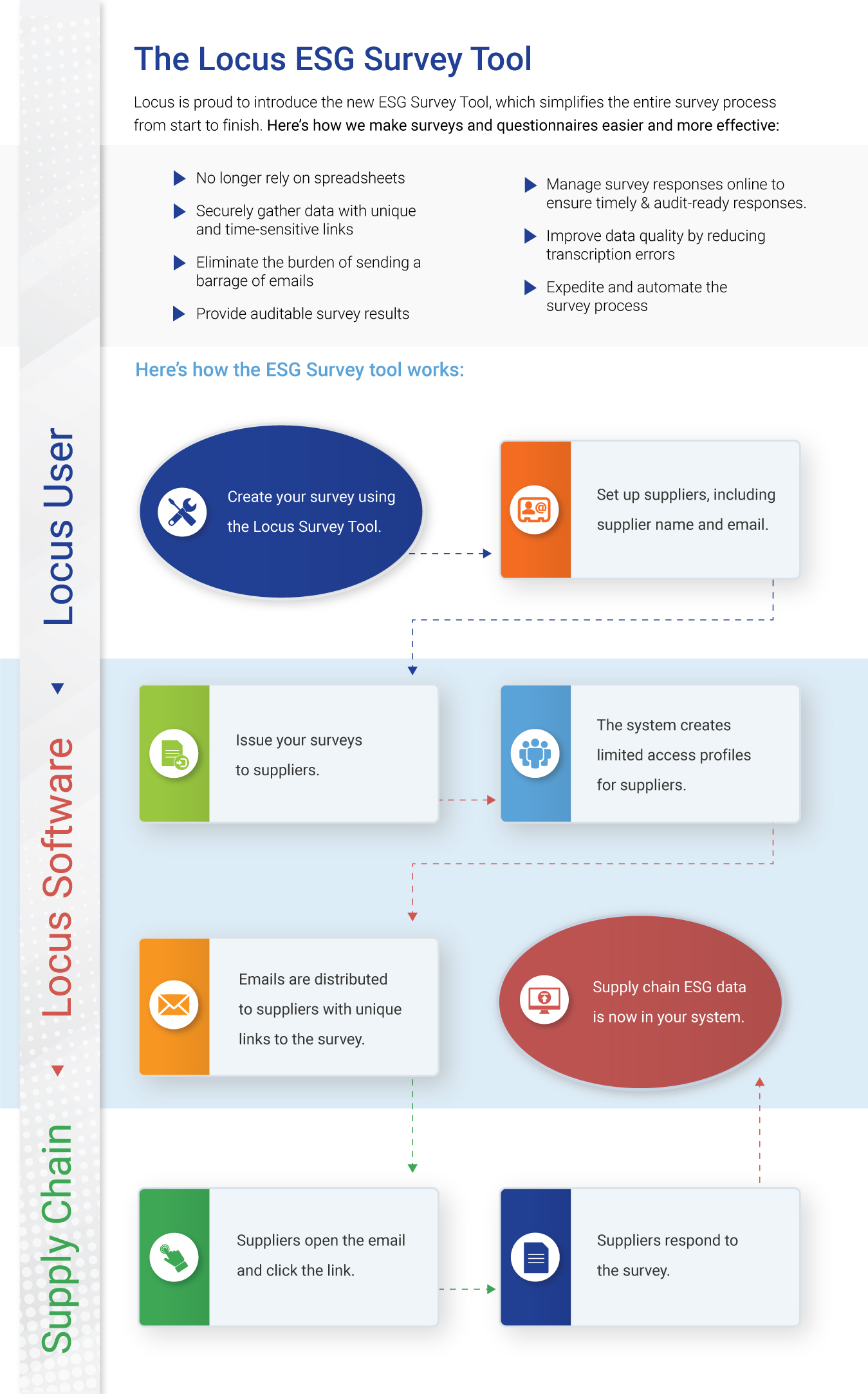
            The Locus Technologies ESG Survey Tool enables users to email surveys and questionnaires directly from Locus to their supply chain. This is achieved without having to create usernames and credentials those receiving surveys.

            When surveys are issued, the tool generates a secure link to each email recipient. Email recipients click the link, respond to the survey or questionnaire (without having to create a Locus username/password), and the data will be captured within Locus software for ESG purposes. Recipients of the link only receive access to their survey form, and nothing else in the system, and the links expire within a prescribed timeframe to further strengthen security.

            The survey tool securely streamlines data collection from external entities who would traditionally never be given access to the system, including suppliers, vendors, sales channels and consultants. Once collected, the data can be immediately be used for ESG calculations and reporting.

            The Locus ESG Survey Tool Infographic

            Want to learn more about the Locus ESG Survey Tool? Reach out to our product specialists today!

              Name

              Company Email

              Phone

              Tell us about your company's needs

              Locus is committed to preserving your privacy.

              7 Useful Visualization Tools for Environmental Management

              The ability to visualize your field and analytical data across maps, logs, and charts is a crucial part of managing environmental information. Locus makes it easy to visually display and export data for sharing in reports and presentations. We’ve compiled 7 of the most useful visualization tools in our environmental information management software.

              Data Callouts

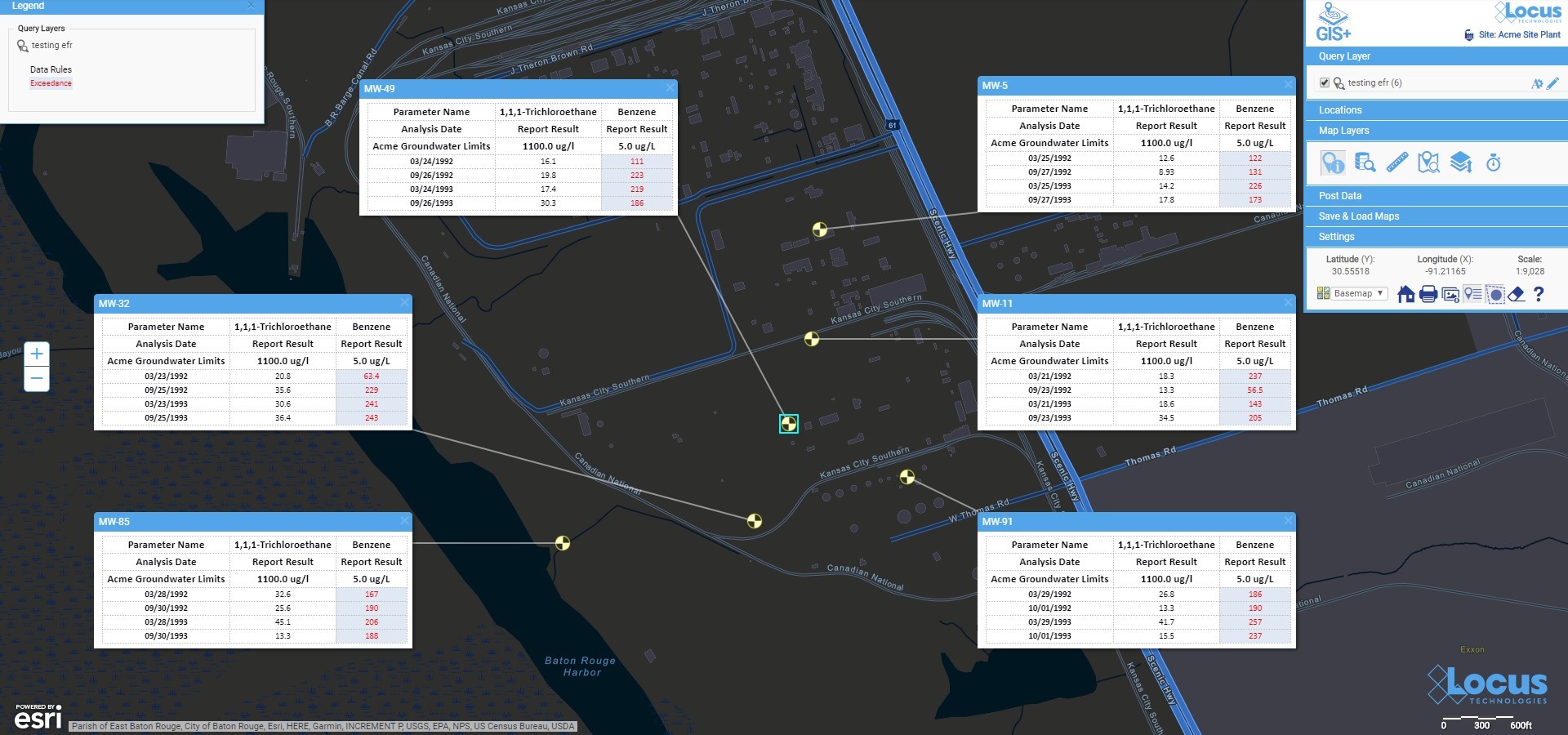
              View your data in easy-to-read text boxes right on your maps. These are location-specific crosstab reports listing analytical, groundwater, or field readings. A user first creates a data callout template using a drag-and-drop interface in the EIM enhanced formatted reports module. The template can include rules to control data formatting (for example, action limit exceedances can be shown in red text). When the user runs the template for a specific set of locations, EIM displays the callouts in the GIS+ as a set of draggable boxes. The user can finalize the callouts in the GIS+ print view and then send the resulting map to a printer or export the map to a PDF file.

              Locus GIS Data Callouts


              Graduated Symbols

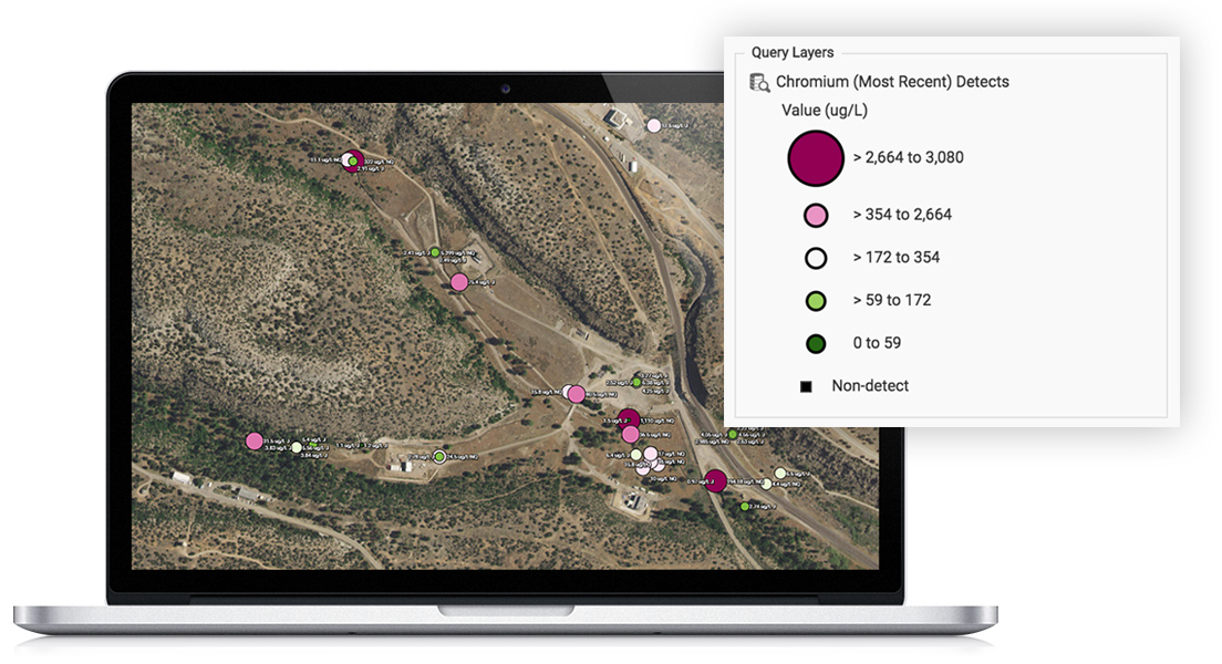
              Locus GIS features high-quality and industry specific graduated symbols so that you can compare relative quantitative data on customizable maps. Choose graduated symbol intervals, sizes, and colors from a large selection of color ramps and create multiple layers for data analysis. It also features a location clustering option, ideal for large sites, a historical challenge for mapping.

              Intellus GIS+ maps


              Charting

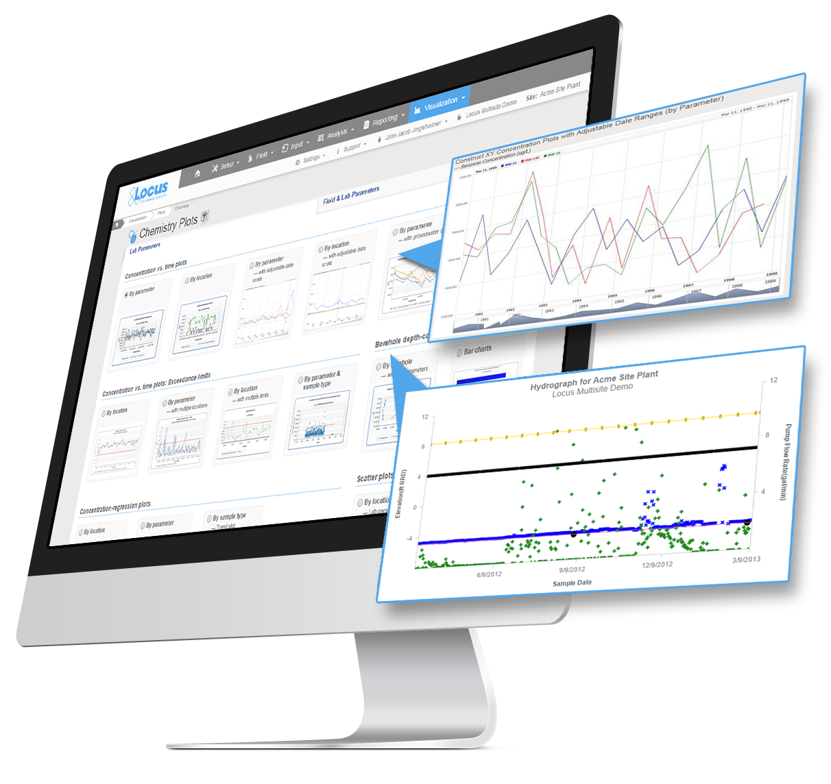
              Multiple charts can be created in EIM at one time. Charts can then be formatted using the Format tab. Formatting can include the ability to add milestone lines and shaded date ranges for specific dates on the x axis. The user can also change font, legend location, line colors, marker sizes and types, date formats, legend text, axis labels, grid line intervals or background colors. In addition, users can choose to display lab qualifiers next to non-detects, show non-detects as white filled points, show results next to data points, add footnotes, change the y-axis to log scale, and more. All of the format options can be saved as a chart style set and applied to sets of charts when they are created.

              Screenshots of EIM chemistry plots menu with two sample plots


              Time Sliders

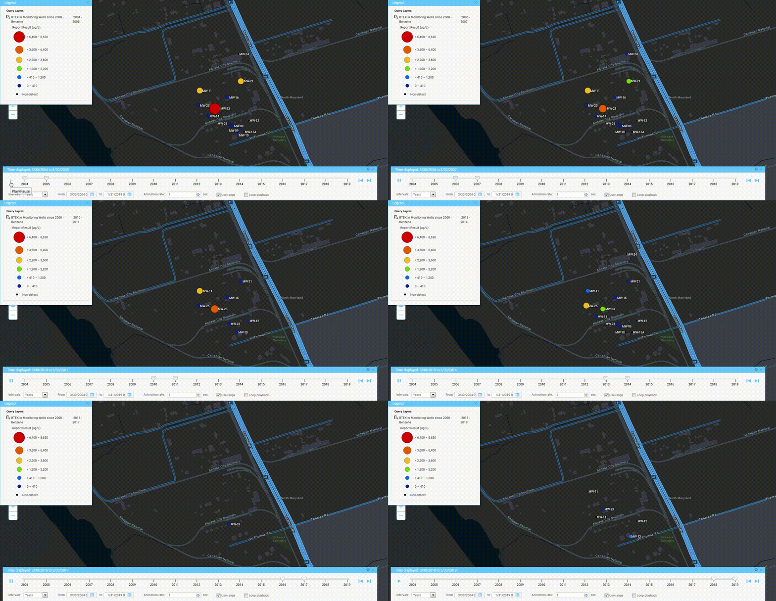
              Locus has adopted animation in its GIS+ solution, which lets a user use a “time slider” to animate chemical concentrations over time. When a user displays EIM data on the GIS+ map, the user can decide to create “time slices” based on a selected date field. The slices can be by century, decade, year, month, week or day, and show the maximum concentration over that time period. Once the slices are created, the user can step through them manually or run them in movie mode.

              GIS+ time slider in action


              Augmented Reality

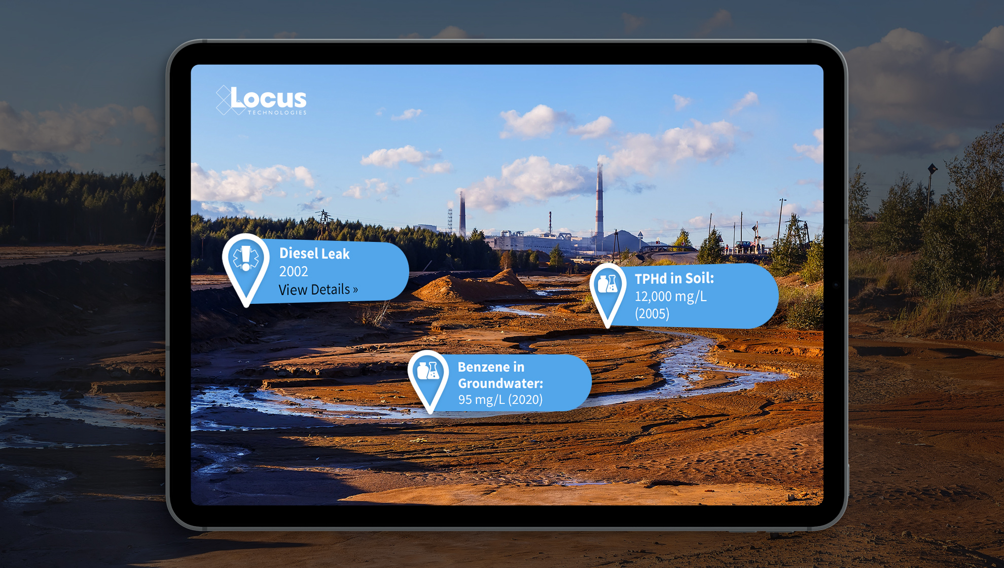
              Locate and identify inspection and/or monitoring locations on your mobile device. View real-time and historical environmental data to quickly find areas of interest for your chemical and subsurface data. Use your camera to get precise geotagged information for spills, safety incidents, historical chemical sources, subsurface utilities, or any other type of EHS data.

              Locus Augmented Reality


              Boring Logs

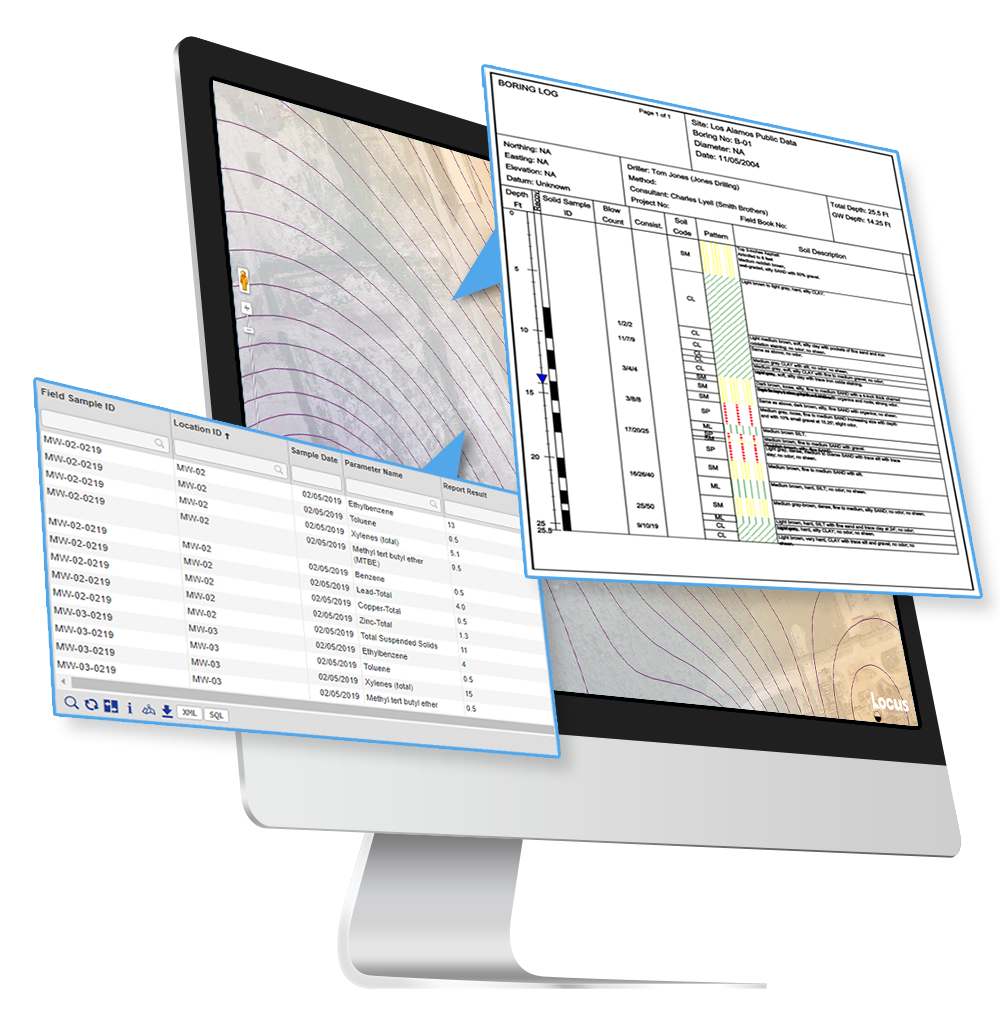
              Create and display clickable boring logs of your sample data—using custom style formats and cross-sections. Show depth ranges, lithology patterns, aquifer information, and detailed descriptions for your samples.

              Locus GIS+ boring logs on groundwater contour lines


              Contours

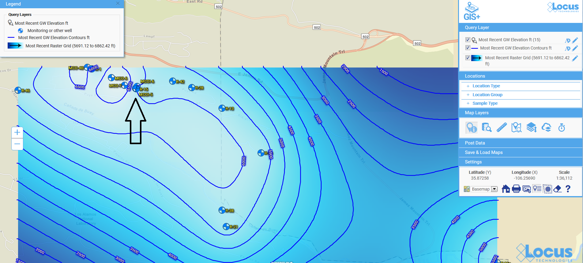
              Create and visualize custom contours using multiple algorithms. Because visualizations let you chunk items together, you can look at the ‘big picture” and not get lost in tables of data results. Your working memory stays within its capacity, your analysis of the information becomes more efficient, and you can gain new insights into your data.

              Contour map for groundwater in Locus GIS+


              Contact us to see more

              Send us your contact information and a Locus representative will be in touch to discuss your organization’s environmental data management needs and provide an estimate, or set up a free demo of our enterprise environmental software solutions.

                Name

                Company Email

                Phone

                Tell us about your company's needs

                Locus is committed to preserving your privacy.

                Top 5 Usability Features in Locus EIM

                Locus Environmental Information Management (EIM) is the leading cloud-based application for managing and reporting environmental data. EIM allows users to gain control and insights into any analytical data, automate laboratory and field data collection, and ditch the patchwork of paper forms, spreadsheets, and disjointed databases for a centralized system. We have highlighted 5 key usability features that allow users to get the most out of their investment.

                Locus Usability - Easy Searches

                Easy Searching

                Throughout EIM, users have many opportunities to create search criteria, then pull up the records that match their data filters. A recent addition to EIM has been well received as it is a game-changer for simplicity. Located to the right of the main menu is a search box. Type in the name of a parameter, then click the resulting View Parameter link. You will see all the relevant information on the parameter, including parameter type, whether it is an aggregate parameter or not, site assignment, molecular weight, toxicity equivalence factor, and so forth. Click the View Matching Field Sample Results link, and you will see all the lab results that are stored in EIM for your selected site and analyte. If the parameter is a field measurement, you will see all applicable field measurements. If a parameter can be either a field measurement or lab analyte, you will see both field readings and laboratory results for the parameter.

                Suppose your entry in the search box is a sampling location rather than the name of a parameter. In that case, you will see matching field measurements, sample collection data, analytical results, and groundwater readings for the indicated location.

                Locus Usability - Rolling Upgrades

                Rolling Upgrades

                Think of the frustration your users or administrators may have experienced graduating from Windows XP to Windows 7 and 8 then 10. We guarantee this will not be repeated with our suite of products. Our Software has no version numbers. Rolling upgrades (included in License) are performed for brief periods during non-standard working hours. These updates will not hide or bury existing features. Over time, the interface may change to take advantage of new tools, but this will be done in a measured manner to improve the user experience. What we strive for is to never have a formerly working function break. If you have a recent vintage browser, you should have access to all functionality that comes with our Software both before and after a release.

                In line with this advantage of our products, Locus is not dependent on maintaining links to other software packages. This is not the case for some of our competitors who rely on links to third-party packages to perform data validation, plotting, and reporting.

                Locus Usability - User Empowerment

                User Empowerment

                Almost all of the tasks that are required to manage our products can be done by our customers. This includes adding new users, permissions, and roles; new valid values; new action limits and screening criteria; new custom reports; editing or deleting groups of records; adding new tables to audit; and creating new EDD formats. The few tasks that Locus must be involved include rollbacks of the database, adding new custom fields and data checks, and developing new functionalities.

                Customers who adopt EIM typically replace a series of spreadsheets that have grown more unwieldy by the year or a homegrown database built with a lower-end product like Access. The keepers or administrators of these spreadsheets and homegrown databases are sometimes concerned about losing access and control. There is no doubt that a cloud-based system that multiple clients access must have rigid controls in place to assure data integrity and completeness. Still, we go to great lengths to accommodate “power users,” allowing them to run their SQL statements in our Custom Query module. This tool is widely used and appreciated by users who formerly managed in-house databases at DOE facilities, large water utilities, environmental consultancies, and leading oil and chemical companies. Finally, and most importantly, Locus is a partner with our customers; if you are not successful with EIM, no one “wins.”

                Locus Usability - User Interface

                Interface Consistency and Simplicity: EIM Grids

                The basic grid that EIM uses to display data is pervasive throughout the system, appearing in multiple places under each of the Setup, Field, Input, Analysis, Reporting, and Visualization main menu options. This grid is mighty. With it, you can filter on individual columns by clicking on a list of values below the column header. You can also sort the values in any column by clicking on an up or down arrow in the column header. You can choose to display 10–1000 records at a time. Other features include an advanced search option, the ability to reorder/select/deselect columns, and the opportunity to export the data displayed in the grid using any of the following export types – CSV, Delimited, Excel, PDF, KMZ, Shapefile, or XML – or you can copy the dataset to your clipboard. The power and ease of use of this grid, coupled with its presence throughout EIM, make the system easy to learn and use for users of all ability levels.

                The usability of the grid is taken to a new level in several places in EIM, where you pull up a set of analytical records that meet the selection criteria that you have specified. When you then click on the map icon in the bottom left corner of the grid, EIM takes you directly to Locus’ GIS module, where the results pulled up on the grid are displayed on a map of your site next to their sampling locations.

                Locus Usability - Save and Reuse Work

                Saving and Reusing Your Work

                While you can often get to the data you need in EIM in a few steps, this is not always the case. Your selection criteria may be complicated, involving multiple fields and entries in the database. Most grids have a default set of fields that are displayed in a predetermined order. You may prefer to reorder these, include additional fields, or remove some of the default selections. If you need a highly formatted instead of a simple tabular report that does not yet exist in EIM, you will need to spend more time inputting the specifications for the report. How can you minimize your effort? You can do so by naming and then saving your selections for repeated use at later times. When you do so, you must tell EIM whether these saved inputs are for private or public use. This feature of EIM saves time, reduces keystrokes, and prevents mistakes (get it right once, then reuse as needed). And, enhances user adoption as power users can create and share the reports their users need most often.

                [sc_button link=”https://www.locustec.com/applications/environmental-information-management/” text=”Learn more about Locus EIM” link_target=”_self” centered=”1″]

                Celebrating 55 years of improving spatial thinking with GIS technology

                Today, November 15, is GIS Day—an annual celebration established in 1999 to showcase the power and flexibility of geographical information systems (GIS).

                Not only is GIS more powerful than ever before—it is also vastly more accessible.  Anyone with Internet access can create custom maps based on publicly available data, from real-time traffic conditions to environmental risk factors, to local shark sightings. Software developers, even those at small companies or startups, now have access to APIs for integrating advanced GIS tools and functionality into their programs.

                As the Director of EIM and GIS Development at Locus, I lead efforts to integrate GIS with our software applications to deliver our customers’ spatial data using the latest GIS technology. Let us take a look at how far GIS has come since I started working with it and at some of the new and exciting possibilities on the horizon.

                Origins of GIS

                Before you can understand where GIS is today, it helps to know how it started out. This year is the 55th anniversary of the work done by Roger Tomlinson in 1962 with the Canada Land Inventory. We consider this the birth of GIS, and Mr. Tomlinson has been called the “father of GIS”.

                The original GIS used computers and digitalization to “unlock” the data in paper maps, making it possible to combine data from multiple maps and perform spatial analyses. For example, in the image shown here from the Canada Land Inventory GIS, farms in Ontario are classified by revenue to map farm performance.
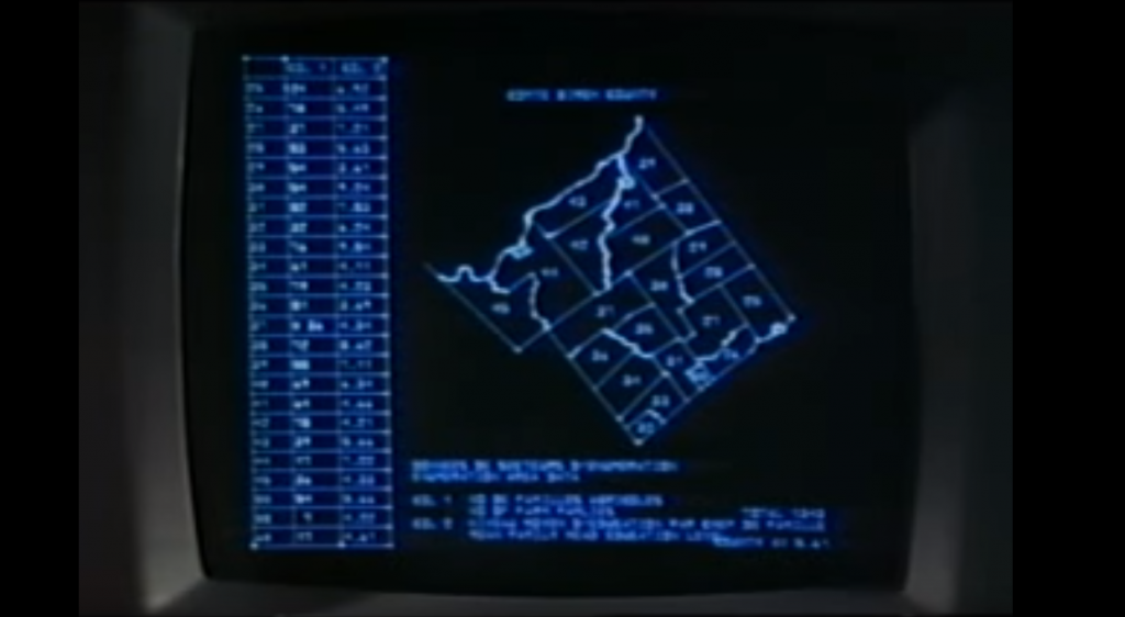
                An early GIS system from the Canada Land Inventory, in Data for Decisions, 1967

                An early GIS system from the Canada Land Inventory, in Data for Decisions, 1967
                Photo: Mbfleming. “Data for Decisions (1967).” YouTube, 12 Aug. 2007, https://youtu.be/ryWcq7Dv4jE.
                  Part 1, Part 2, Part 3

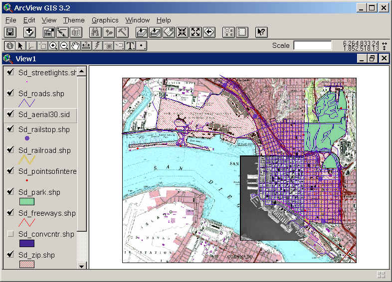
                In 1969, Jack Dangermond founded Esri, which became the maker of, arguably, the world’s most popular commercial GIS software. Esri’s first commercial GIS, ARC/INFO, was released in 1982, and the simpler ArcView program followed in 1991. That year, 1991, is also the year I started working with GIS, although I used the TransCAD system from Caliper before starting with Esri software a few years later.

                Back then, GIS work required expensive software packages installed on personal computers or large mainframe systems. There was no Google Maps; all map data had to be manually loaded into your software. Getting useful data into a GIS usually required extensive file manipulation and expertise in coordinate systems, projections, and geodesy.

                While the government, utility, and resource management sectors used GIS heavily, there was not much consumer or personal use of GIS. As for me, I spent a lot of time in my first job digitizing paper maps by hand or trying to figure out why the map data I had loaded into a GIS was not lining up properly with an aerial photo.

                Esri’s ArcView 3.2 for desktop computers (from the 1990s)

                Esri’s ArcView 3.2 for desktop computers (from the 1990s)
                https://map.sdsu.edu/geog583/lecture/Unit-3.htm

                The Google Revolution

                How much has changed since those early days! After the release of OpenStreetMap in 2004, Google Maps and Google Earth in 2005, and Google Street View in 2007, GIS has been on an unstoppable journey—from only being used by dedicated GIS professionals on large computers in specific workplaces, to be accessible to anyone with an internet browser or a smartphone. High-quality map data and images—often the most expensive item in a GIS project in the 1990’s — are now practically free.

                Just think how revolutionary it is that anyone can have instant access to detailed satellite images and road maps of almost anywhere on Earth! Not only can you perform such mundane tasks as finding the fastest route between two cities or locating your favorite coffee shop while on vacation—you can also see live traffic conditions for cities across the globe; view aerial images of countries you have never visited, and get street level views of exotic places. Back in 1991, such widespread access to free map data would have seemed like something straight out of science fiction.
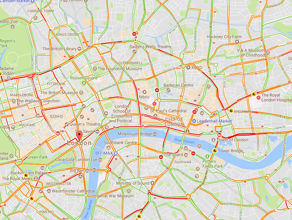
                Traffic conditions in London, 3:30 pm 10/16/2017, from Google Maps

                Traffic conditions in London, 3:30 pm 10/16/2017, from Google Maps

                South Base Camp, Mount Everest, Google StreetView

                South Base Camp, Mount Everest, Google StreetView

                Mashups in the cloud

                Obviously, the amount of spatial data needed to provide detailed coverage of the entire globe is far too large to be stored on one laptop or phone. Instead, the data is distributed across many servers “in the cloud.” Back in the 1990s, everything for one GIS system (data, processing engine, user interface) needed to be in the same physical place—usually one hard drive or server. Now, thanks to the internet and cloud computing, the data can be separate from the software, creating “distributed” GIS.

                The combination of freely available data with distributed GIS and the power of smart phones has led us to the age of “neogeography”—in which anyone (with some technical knowledge) can contribute to online maps, or host their maps with data relevant to their personal or professional needs. GIS no longer requires expensive software or cartographical expertise; now, even casual users can create maps linking multiple data sources, all in the cloud.

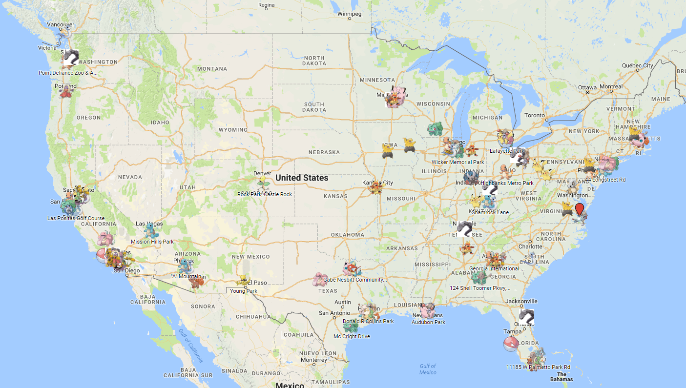
                Google’s MyMaps is an example of a tool for easily making your maps. Maps can range from the playful, such as locations of “Pokemon nests,” to the serious, such as wildfire conditions.

                These online maps can be updated in real time (unlike paper maps) and therefore kept current with actual conditions. Such immediate response is instrumental in emergency management, where conditions can change rapidly, and both first responders and the public need access to the latest data.

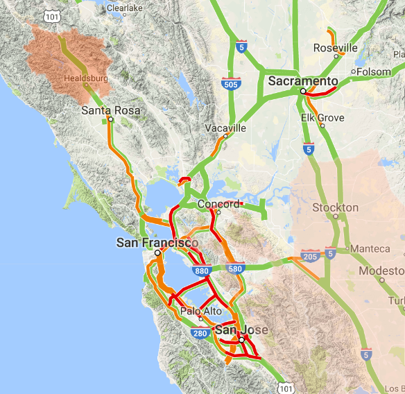
                Map showing wildfire and traffic conditions in northern California, 10/16/2017

                Map showing wildfire and traffic conditions in northern California, 10/16/2017
                https://google.org/crisismap/us-wildfires

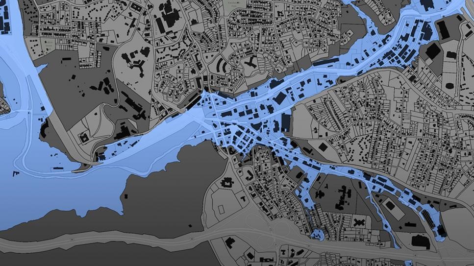
                Furthermore, software programmers have created online GIS tools that let non-coders create their maps. These tools push the boundaries of distributed GIS even further by putting the processing engine in the cloud with the data. Only the user interface runs locally for a given user. During this period of GIS history, I created several mashups, including one for viewing natural hazard risks for my hometown. For this application, I combined several data types, including property lines, flood plains, landslide vulnerability, and wildfire risk.

                Floodplain data for Buncombe County, NC

                Floodplain data for Buncombe County, NC
                https://buncombe-risk-tool.nemac.org

                Programming GIS with APIs

                Another significant advance in GIS technology is the ability to integrate or include advanced GIS tools and features in other computer programs. Companies such as Google and Esri have provided toolkits (called APIs, or application programming interfaces) that let coders access GIS data and functions inside their programs. While neogeography shows the power of personal maps created by the untrained public, computer programmers can use APIs to create some very sophisticated online GIS tools aimed at specific professionals or the public.

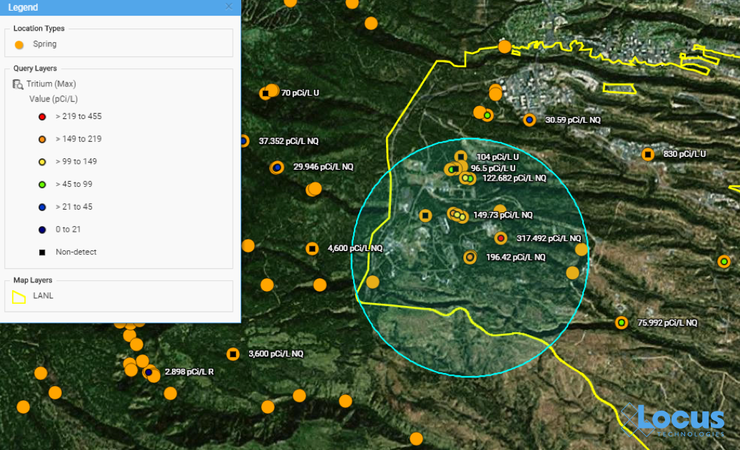
                During my 10 years at Locus, I have helped create several such advanced GIS tools for environmental monitoring and data management. One example is the publicly-available Intellus application that Locus Technologies developed and hosts for the US Department of Energy’s Los Alamos National Laboratory. It uses an Esri API and distributed GIS to provide access to aerial images and many decades of environmental monitoring data for the Los Alamos, NM area. Users can make maps showing chemical concentrations near their home or workplace, and they can perform powerful spatial searches (e.g., “find all samples taken within one mile of my house in the last year”). The results can be color-coded based on concentration values to identify “hot spots”.

                Map from Intellus showing Tritium concentrations near a specified location

                Map from Intellus showing Tritium concentrations near a specified location
                https://www.intellusnmdata.com

                Locus Technologies also provides more sophisticated forms of analysis in its EIM cloud-based environmental management system. For example, contour lines can be generated on a map showing constant values of groundwater elevation, which is useful for determining water flow below ground. With such powerful spatial tools in the cloud, anyone at the organization, from facility managers to scientists, can easily create and share maps that provide insight into data trends and patterns at their site.
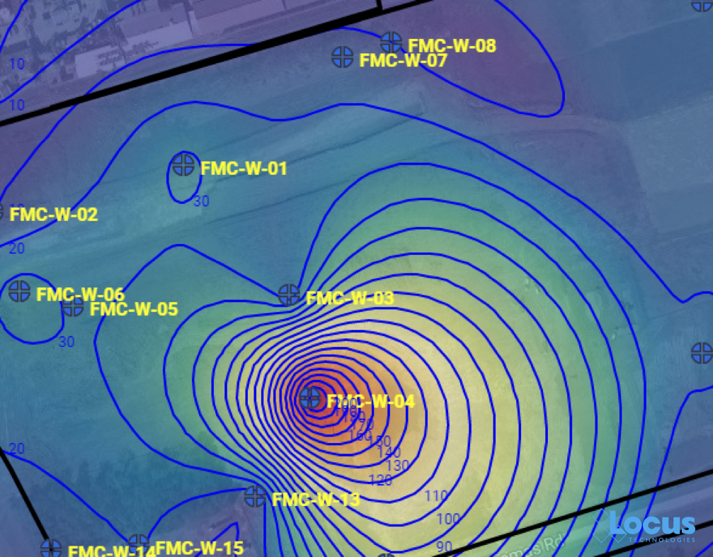
                Groundwater contour map

                Groundwater contour map where each line is a 10 ft. interval, from the Locus EIM system

                There’s a (map) app for that

                One particularly exciting aspect of GIS today is the ability to use GIS on a smartphone or tablet. The GIS APIs mentioned above usually have versions for mobile devices, as well as for browsers. Programmers have taken advantage of these mobile APIs, along with freely available map data from the cloud, to create apps that seamlessly embed maps into the user experience. By using a smartphone’s ability to pinpoint your current latitude and longitude, these apps can create personalized maps based on your actual location.

                A search in the Apple AppStore for “map” returns thousands of apps with map components. Some of these apps put maps front-and-center for traditional navigation, whether by car (Waze, MapQuest, Google), public transit (New York Subway MTA Map, London Tube Map), or on foot (Runkeeper, Map My Run, AllTrails). Other apps use maps in a supporting role to allow users to find nearby places; for example, banking apps usually have a map to show branches near your current location.

                What’s really exciting are the apps that allow users to enter data themselves via a map interface. For example, HealthMap’s Outbreaks Near Me not only shows reports of disease outbreaks near your location, but it also lets you enter unreported incidents. The GasBuddy app shows the latest gasoline prices and lets you enter in current prices. This “crowdsourcing” feature keeps an app up-to-date by letting its users update the map with the latest conditions as they are happening.
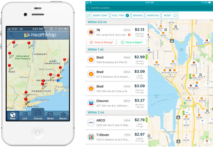
                The Outbreaks Near Me app for phones (left) and the GasBuddy app for tablets (right)

                The Outbreaks Near Me app for phones (left) and the GasBuddy app for tablets (right)

                Here at Locus Technologies, we use the power of GIS in our Locus Mobile app for field data collection. Users can enter environmental data, such as temperature or pH measurements from a monitoring well, and upload the data back to the EIM cloud for later review and analysis. The Locus Mobile app includes a map interface for navigating to data collection points and tracking visited locations. The app also lets users create new data collection points “on the fly” simply by clicking on the map.
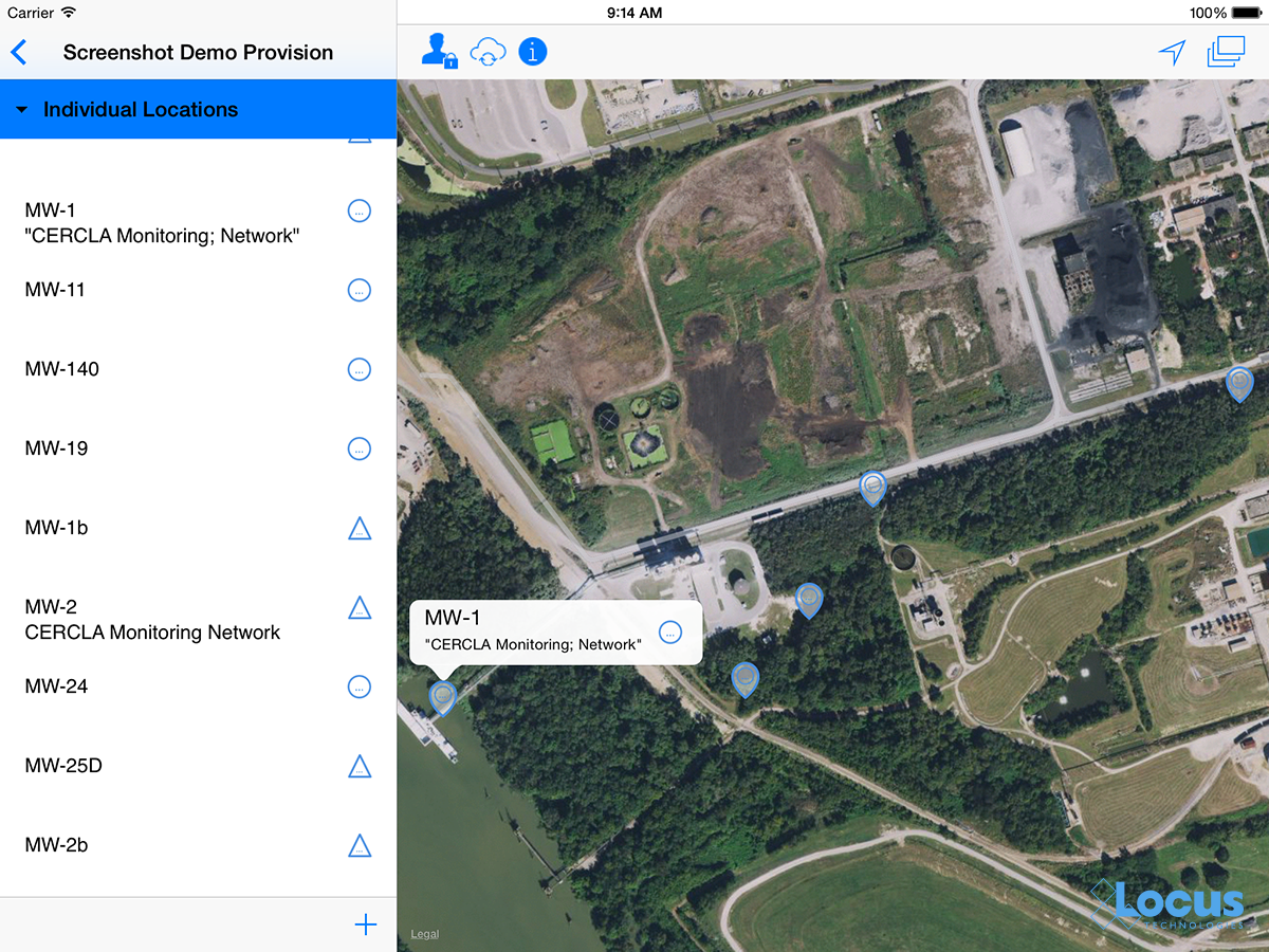
                Locus Mobile map interface

                The map interface in the Locus Mobile app; blue dotted circles indicate locations that are not yet started.

                Looking to the future

                Where will GIS go from here? It’s possible that augmented reality, virtual reality, and 3D visualization will continue to expand and become as ubiquitous as the current “2D” maps on browsers and phones. Also, the “internet of things” will surely have a GIS component because every physical “thing” can be tied to a geographical location. Similarly, GIS can play an important role in “big data” by providing the spatial framework for analysis. It will be interesting to see where GIS is when we celebrate the 20th GIS Day in 2019!

                Thanks to the GIS Timeline for providing some of the history for this article.


                Locus employee Todd PierceAbout guest blogger— Dr. Todd Pierce, Locus Technologies

                Dr. Pierce manages a team of programmers tasked with development and implementation of Locus’ EIM application, which lets users manage their environmental data in the cloud using Software-as-a-Service technology. Dr. Pierce is also directly responsible for research and development of Locus’ GIS (geographic information systems) and visualization tools for mapping analytical and subsurface data. Dr. Pierce earned his GIS Professional (GISP) certification in 2010.


                [jwplayer mediaid=”16590″]

                Interested in Locus’ GIS solutions?

                Introducing Locus GIS+. All the functionality you love in EIM’s classic Google Maps GIS for environmental management— now integrated with the powerful cartography, interoperability, & smart-mapping features of Esri’s ArcGIS platform!

                Learn more about GIS+


                Locus’ Intellus Site Creates Big Data Transparency in the Cloud; Millions of Environmental Data Records are Now Publicly Available

                Through the Locus EIM platform public facing website, Intellus, the general public can now access remediation and environmental data records associated with the Office of Environmental Management’s (EM’s) legacy nuclear cleanup program.

                Containing more than 14 million records, Locus’ Intellus has consolidated Los Alamos National Laboratory’s (LANL’s) information that was previously handled in multiple independent databases. The centralized, cloud-based solution directly attributed to an estimated $15 million in cost savings for LANL through 2015.

                The public facing site also ensures users have real-time access to the most recent data. The same data that scientists and analysts use to base important environmental stewardship decisions off of. Through tools and capabilities such as automated electronic data validation, interactive maps, and the ability to include data from other third-party providers and environmental programs, Intellus provides the ultimate platform to view LANL’s environmental data without compromising the core EIM system that LANL scientists use on a daily basis.

                Locus has always advocated for the power of data transparency via the cloud. When you apply the most extensive security protocols to a cloud-based system, it can be a winning combination for data management and public trust.

                Tag Archive for: Environmental Data

                Nothing Found

                Sorry, no posts matched your criteria