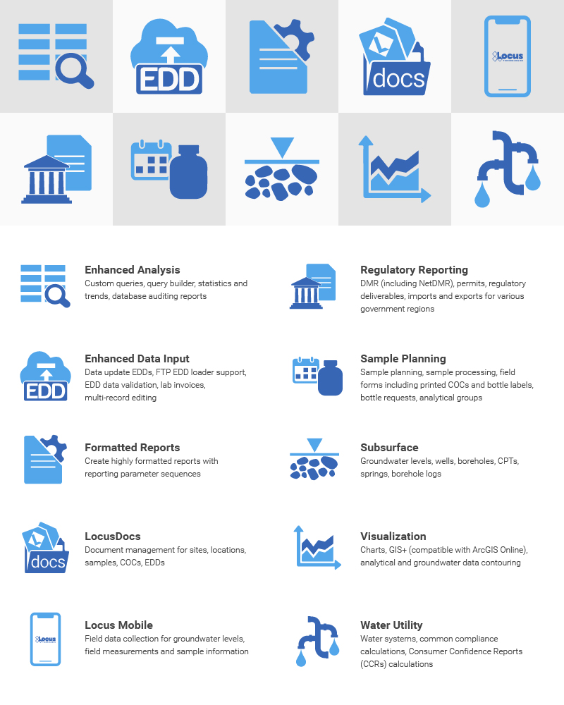
Streamline and Simplify Annual CCR Preparation
Streamline and simplify annual CCR preparation with Locus water quality software—designed for water systems to simplify the sampling, management, and reporting of drinking water data.
Streamline and simplify annual CCR preparation with Locus water quality software—designed for water systems to simplify the sampling, management, and reporting of drinking water data.
Humankind has produced hundreds of millions of tons of plastics since the 1950s. A relatively small proportion of these plastics (less than 10%) has been recycled; some has been incinerated; and a significant amount has been entombed in landfills. A small, but significant proportion of those plastics end up as microplastics (plastic particles less than 5 microns in size). Experts estimate that as many as 1.5 million tons of microplastics are released to surface water (oceans, rivers, lakes) every year. These particles don’t readily break down in the environment—which means they accumulate in the water.
So what does that mean? If even half of the microplastics that entered the waters over the last 10 years are still there, and they are evenly distributed across all the water on Earth, it means that every liter of water on the planet has over 500 tiny pieces of plastic floating around in it.
Of course, the plastic isn’t evenly distributed—we haven’t contaminated the deep oceans to the same extent we’ve contaminated rivers, lakes and other surface waters, from which we draw our drinking water. The World Health Organization (WHO) recently reported that studies of drinking water show it contains up to 1000 particles/L. WHO showed that the two most common plastic particle were PET (polyethylene terephthalate), commonly found in clothing and food containers, and polypropylene (bags, packaging and some fibers).
People don’t know how bad these are. General consensus among experts is it depends on the type of plastics: polyethylene is probably not bad, phthalates are worse, and chlorinated compounds such as vinyl chloride are far worse.
Regulators are starting to take notice: REACH in EU and CA both have proposed regulations for microplastics in drinking water. The REACH regulations attack the problem at the source. They include measurement of microplastics that are shed from clothing and fibers, which are the source of up to 35% of the microplastics in the environment. California will likely start with a preliminary guideline to help water suppliers measure and assess the microplastics in their systems.
As a drinking water supplier, you need to be prepare to manage microplastics. A good first step is having a flexible software system such as Locus, in place to track microplastics. The system should track the sampling and lab methodology as well as the data results, so you can continue not just to track your data, but assess its meaning in the face of evolving regulations and methodologies.
As a consumer of water, begin by cutting down on plastics usage. Wear cotton or other apparel which doesn’t include synthetics.
About the Author—Steve Paff, Locus Technologies
Steve Paff is a Sales Engineer, Product Manager and Implementation specialist with over 25-years’ experience delivering quality software solutions for environmental, health, safety and sustainability. Mr. Paff has extensive experience in many of the industry’s software suites. He came to Locus as Senior Sales Engineer after developing and launching a Covid-19 contact tracing app and developing an app to track sustainability metrics across the global apparel supply chain.
Attention all water providers: the EPA’s UCMR 5 list includes 30 contaminants (29 PFAS and lithium) that both small and large water systems have to test for and report. Can your current environmental solution handle it?
Locus EIM environmental software can handle new chemicals and analyses seamlessly. Both the standard Locus EIM configuration and the Locus EIM Water configuration (specially tailored to water utilities) are built with ever-changing regulations in mind.
We’ve put together some helpful background and tips for water providers preparing for UCMR 5 monitoring.
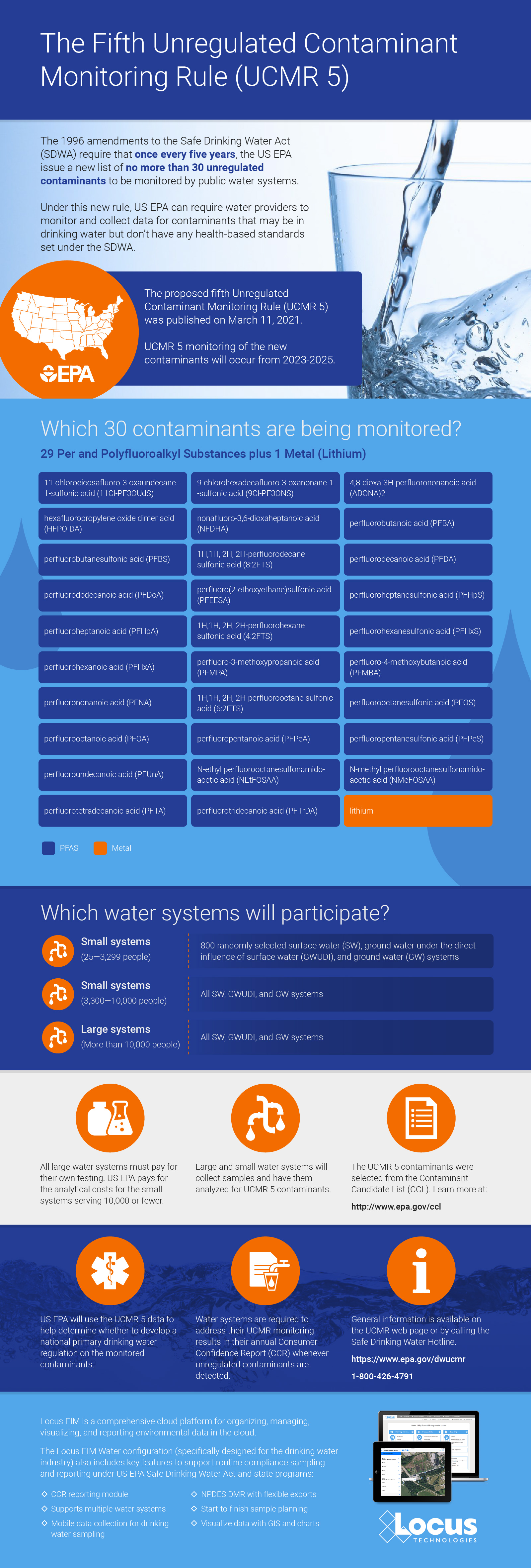
In 1996, Congress amended the Safe Drinking Water Act with the Unregulated Contaminant Monitoring Rule (UCMR). Under this new rule, US EPA can require water providers to monitor and collect data for contaminants that may be in drinking water but don’t have any health-based standards set (yet) under the SDWA.
More than 150,000 public water systems are subject to the SDWA regulations. US EPA, states, tribes, water systems, and the public all work together to protect the water supply from an ever-growing list of contaminants.
However, under the UCMR, US EPA is restricted to issuing a new list every five years of no more than 30 unregulated contaminants to be monitored by water providers.
This helps reduce the burden on water providers, since monitoring and testing for the existing long list of regulated contaminants already requires a significant investment of time and resources.
Throughout the course of this monitoring, US EPA can determine whether the contaminants need to be officially enforced— but this would require regulatory action, routed through the normal legislative process.
Contact your Locus Account Manager for help setting up your EIM database in advance of your sampling schedule, and we’ll make sure you’re equipped for UCMR 5!
Not yet a customer? Send us a quick note to schedule a call or a demo to find out how Locus software can completely streamline your water sampling and reporting.
More helpful links:
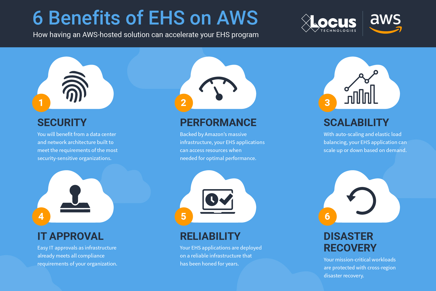
Let’s look back on the most exciting new features and changes made in EIM, Locus’ environmental data management software, during 2019!
In August, Locus migrated EIM into the Amazon Web Services (AWS) cloud. EIM already had superior security, reliability, and performance in the Locus Cloud. The move to AWS improves on those metrics and allows Locus to leverage AWS specific tools that handle big data, blockchain, machine learning, and data analytics. Furthermore, AWS is scalable, which means EIM can better handle demand during peak usage periods. The move to AWS helps ensure that EIM remains the world’s leading water quality management software.
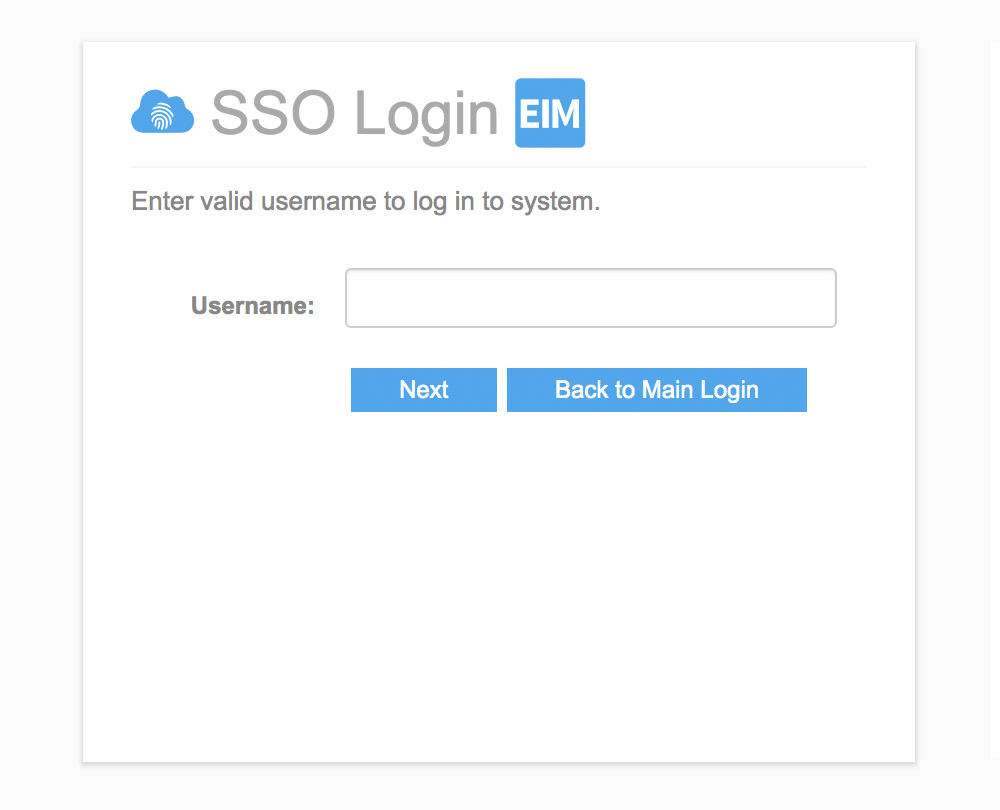
EIM now supports Single Sign-On (SSO), allowing users to access EIM using their corporate authentication provider. SSO is a popular security mechanism for many corporations. With SSO, one single login allows access to multiple applications, which simplifies username and password management and reduces the number of potential targets for malicious hacking of user credentials. Using SSO with EIM requires a one-time configuration to allow EIM to communicate with a customer’s SSO provider.
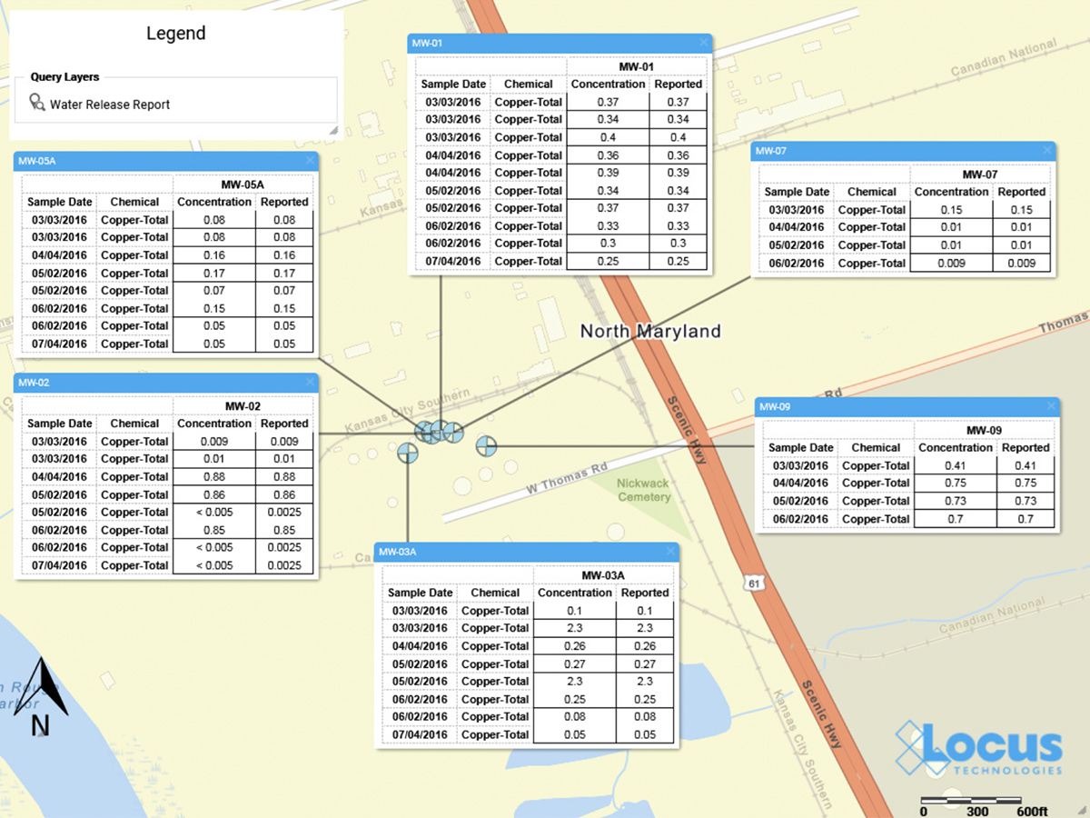
The Locus GIS+ solution now supports creating data callouts, which are location-specific crosstab reports listing analytical, groundwater, or field readings. A user first creates a data callout template using a drag-and-drop interface in the EIM enhanced formatted reports module. The template can include rules to control data formatting (for example, action limit exceedances can be shown in red text). When the user runs the template for a specific set of locations, EIM displays the callouts in the GIS+ as a set of draggable boxes. The user can finalize the callouts in the GIS+ print view and then send the resulting map to a printer or export the map to a PDF file.
For customers who don’t require the full EIM package, Locus now offers EIM One, which gives the ability to customize EIM functionality. Every EIM One purchase comes with EIM core features: locations and samples; analytical and field results; EDD loading; basic data views; and action limit exceedance reports. The customer can then purchase add-on packages to get just the functionality desired–for example a customer with DMR requirements may purchase the Subsurface and Regulatory Reporting packages. EIM One provides customers with a range of pricing options to get the perfect fit for their data management needs.
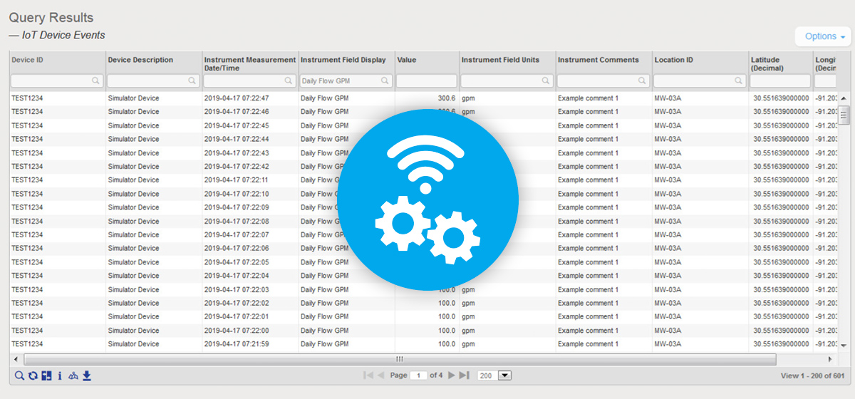
EIM can now be configured to accept data from IoT (internet of things) streaming devices. Locus must do a one-time connection between EIM and the customer’s IoT streaming application; the customer can then use EIM to define the devices and data fields to capture. EIM can accept data from multiple devices every second. Once the data values are in EIM, they can be exported using the Expert Query tool. From there, values can be shown on the GIS+ map if desired. The GIS+ Time Slider automation feature has also been updated to handle IoT data by allowing the time slider to use hours, minutes, and seconds as the time intervals.
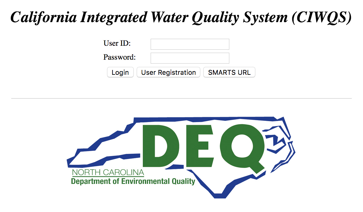
EIM currently supports several dozen regulatory agency export formats. In 2019, Locus added two more exports for CIWQS (California Integrated Water Quality System Project) and the NCDEQ (North Carolina Department of Environmental Quality). Locus continues to add more formats so customers can meet their reporting requirements.
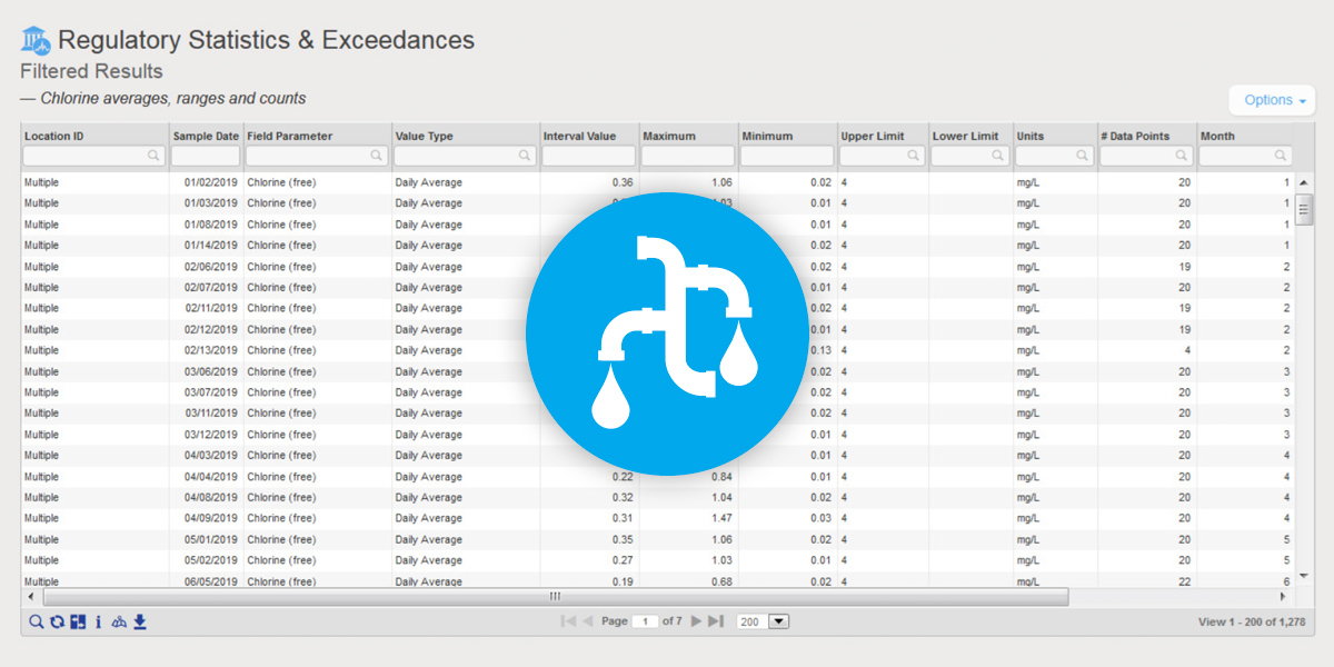
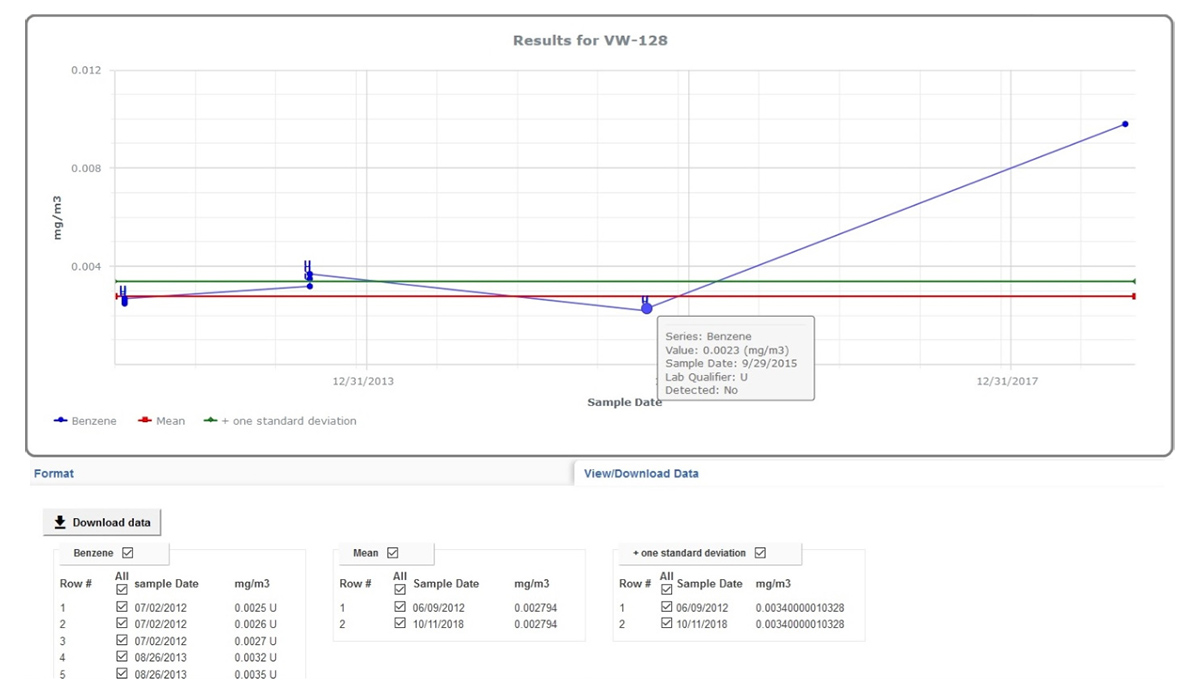
EIM is the world’s leading water quality management software, and has been used since 1999 by many Fortune 500 companies, water utilities, and the US Government. Locus added two key reports to EIM for Water in 2019 to further support water quality reporting. The first new report returns chlorine averages, ranges, and counts. The second new report supports the US EPA’s Lead and Copper rule and includes a charting option. Locus will continue to enhance EIM for Water by releasing the 2019 updates for the Consumer Confidence Report in January 2020.
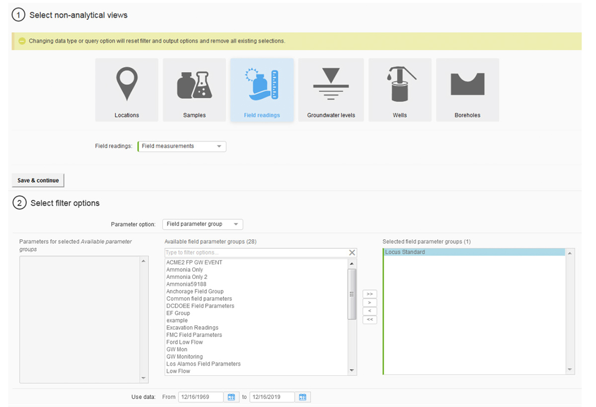
Locus continues to upgrade and improve the EIM user interface and user experience. The most noticeable change in 2019 was the overhaul of the Non-analytical Views pages in EIM, which support data exports for locations, samples, field readings, groundwater levels, and subsurface information. Roughly 25 separate pages were combined into one page that supports all these data views. Users are directed through a series of filter selections that culminate in a grid of results. The new page improves usability and provides one centralized place for these data reports. Locus plans to upgrade the Analytical Views in the same way in 2020.
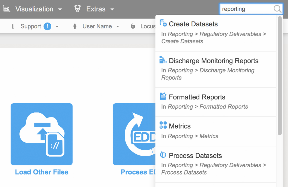
To help customers find the correct EIM menu function, Locus added a search box at the top right of EIM. The search box returns any menu items that match the user’s entered search term. In 2020, Locus will expand this search box to return matching help file documents and EDD error help, as well as searches for synonyms of menu items.
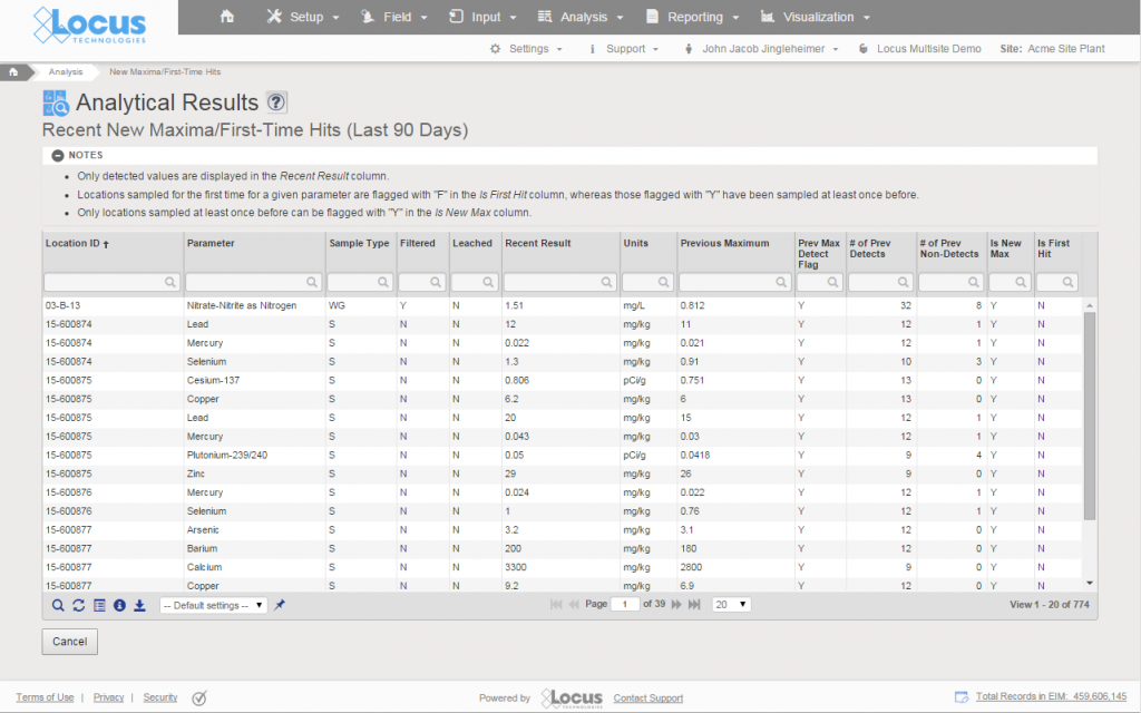
The EIM EDD loader now has a new “View history” option for viewing previously loaded data for the locations and parameters in the EDD. This function lets users put data in the EDD holding table into proper historical context. Users can check for any unexpected increases in parameter concentrations as well as new maximum values for a given location and parameter.
The Environmental Protection Agency (EPA) announced that it would impose stricter requirements on water utilities to manage lead and copper contamination in drinking water supplies. The EPA said that tackling water pollution is a core duty of the agency.
The proposed changes, the first affecting lead level in water since 1991, would also give utilities more time to replace lead pipes in their systems. Some environmental groups are not happy with the proposed rule because the change slows by 20 years the timeline for removing aging lead service pipes that could expose children to lead. Lead is a toxin known to harm developing brains. The rule slows down the removal of pipelines where lead levels exceed 15 μg/L to 33 years from the 13 years in the original law.
The new rule requires water utilities to identify and remove sources of lead when a water sample at faucet exceeds 15 micrograms per liter (μg/L). The EPA said water systems would also have to follow new, improved sampling procedures and adjust sampling sites to better target locations with higher lead levels.
Health advocates estimate that as many as six million or more lead water lines remain underground in U.S. cities and towns. Additional sampling and monitoring can help to identify affected areas, and ensure the quality of drinking water sources.
In most cities in the US, drinking water quality conforms with the norms of the Safe Drinking Water Act, which requires EPA to set Maximum Contaminant Levels (MCL) for potential pollutants. Besides, the EPA’s Consumer Confidence Rule (CCR) of 1998 requires most public water suppliers to provide consumer confidence reports, also known as annual water quality reports, to their customers.
PFAS stands for “perfluoroalkyl and polyfluoroalkyl substances,” with the most important thing to know that this large group of synthetic chemicals includes perfluorooctanoic acid (PFOA) and perfluorooctane sulfonate (PFOS).
Not Regulated by EPA
When it comes to drinking water from the tap in the US, the phrase that fits concerning PFOA and PFOS is “caveat emptor” (buyer beware). The EPA has not regulated these chemicals. There are no federal regulations for PFOA and PFOS in drinking water in the US.
In May 2016, the EPA established a drinking water “health advisory” of 70 parts per trillion (ppt) for the combined concentrations of PFOA and PFOS. While that was a start, there’s a big difference between a health advisory and a regulation that has teeth. Moreover, many scientists consider 70 ppt too high a limit. Reportedly, the EPA is considering turning its 70 ppt health advisory into regulation.
Meanwhile, some states have stepped up to the plate to protect their residents and visitors better. In April 2019, for instance, the New Jersey Department of Environmental Protection (DEP) proposed maximum contamination levels (MCLs) of 14 ppt for PFOA and 13 ppt for PFOS in the state’s drinking water.
As a water consumer, you should be aware of this crisis, as it has the potential to affect both your health and wealth.
What are PFOA and PFOS?
This toxic couple has contaminated the drinking water supply in areas surrounding some industrial sites and military bases. They’re the most studied of the PFAS group because they’re the ones that have been produced in the most significant quantities in the United States, according to the US Environmental Protection Agency (EPA).
PFOA and PFOS, which repel water and stains of various types, have been used as coatings on fabrics and leather and in the production of stain-repellent carpeting and are found in firefighting foams — which have been used extensively on US military bases for decades — among other products. Moreover, some related polyfluoroalkyl compounds can be transformed into these chemicals in the environment, per the National Institutes of Health (NIH), with the Environmental Working Group (EWG) stating that some perfluorinated chemicals not only break down into PFOA in the environment but also can do so in the human body.
While PFOA and PFOS are no longer made in the US, that hardly matters in our global economy. Both are still produced internationally, which means they end up in our country via imports of consumer goods such as carpet, apparel, textiles, and paper and packaging.
Why all the concern about PFOA and PFOS?
These chemicals — dubbed “forever chemicals” because they’re persistent in the environment and the human body — have been linked to cancer, thyroid disease, weakened the immune system and liver function, low infant birth weight, and other health problems, according to many sources.
And this is what the EPA says: “There is evidence that exposure to PFAS can lead to adverse health outcomes in humans. If humans, or animals, ingest PFAS…the PFAS are absorbed and can accumulate in the body. PFAS stay in the human body for long periods. As a result, as people get exposed to PFAS from different sources over time, the level of PFAS in their bodies may increase to the point where they suffer from adverse health effects.”
In most industrialized cities around the world, drinking water is readily available and safe. Safeguarding groundwater (aquifers), streams, rivers, reservoirs, and lakes is crucial to continue delivering clean water on the tap. So is testing and validated water quality data. There are several aspects of drinking water quality that is of concern in the United States, including Cryptosporidium, disinfection by-products, lead, perchlorates, and pharmaceutical substances.
Recent headlines about water quality issues in cities like Flint, Pittsburgh, Asheville, or Rome and Cape Town are motivating consumers to ask more questions about their water quality. Albuquerque’s groundwater is becoming seriously depleted; Fresno’s groundwater is highly susceptible to contamination; In Atlanta, Chicago, Detroit, Houston, Los Angeles, New Orleans, Newark, Philadelphia, Phoenix, San Diego and Washington, D.C., source water is threatened by runoff and industrial or sewage contamination; Water supplies in Baltimore, Fresno, Los Angeles, New Orleans, San Diego, and several other cities are vulnerable to agricultural pollution containing nitrogen, pesticides or sediment.
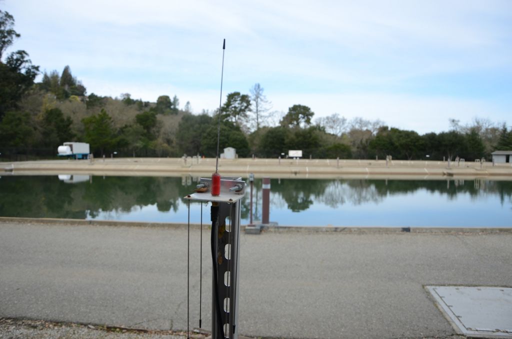
Locus Technologies IoT Monitoring. Connected at all times.
In most cities in the US, drinking water quality is in conformity with the norms of the Safe Drinking Water Act, which requires EPA to set Maximum Contaminant Levels (MCL) for potential pollutants. In addition, the EPA’s Consumer Confidence Report (CCR) Rule of 1998 requires most public water suppliers to provide consumer confidence reports, also known as annual water quality reports, to their customers. Each year by July 1 anyone connected to a public water system should receive in the mail an annual water quality report that tells where water in a specific locality comes from and what’s in it. Locus EIM automates this reporting and allows utilities to be transparent by publishing CCR online in real time so that consumers have access to their CCR at all times. Consumers can also find out about these local reports on a map provided by EPA.
Utilities must maintain good water quality records and manage them in a secure database with built-in alerts for any outliers so that responsible water quality managers can react quickly when there is exceedance of MCL or another regulatory limit.
Learn more about our water solutions.
Last month I got the opportunity to attend AWWA Water Quality and Technology Conference in Toronto, Canada. I was very enthusiastic to interact first hand with end-users of different water technology tools, and interact with other water technology professionals. It’s one thing to design software and support it, it’s a whole different thing to sit and talk with the real customers and real end users and get unfiltered feedback.
As a Product Manager, I’m usually connected with our customers by the various email and messaging systems that provide an endless amount of documentation, but nothing can substitute for an in person conversation. I heard first-hand how there is a need to change existing business practices and stop using older, non-integrated systems that only provide part of the data solution. This scenario is not a new problem; there is a need by most water entities to centralize data, and more easily load, share, analyze and report data. I have had this general conversation many times, but the more in depth, one-on-one conversations about sample planning and data collection provided the most useful feedback. I had the opportunity to give a brief demonstration on “Scheduling and collecting routine water samples using Locus Mobile and EIM” at AWWA, which provided a great venue for candid feedback. Based on these conversations, I have summarized a list of frequent challenges that users encounter during their water sampling process and how they can be solved using the right tools or better communications.
The overall feedback I heard from attendees is their sampling is generally routine, but the planning tools need to allow flexibility in terms of different sampling intervals and date ranges, different field and analytical parameters, and account for location grouping. Using a well-designed application can pull together all of this detailed information, and can provide a summary view of the individual samples. A manager can easily view sample status, and whether the sample is complete, in process, or planned. A well-designed application can also generate the chain of custody (COC), and lab and sample shipping date information and labels per sample, which is a huge time saver. This type of sample tracking detail seemed to be very useful to many conference attendees to help ensure they are in regulatory compliance with required sampling frequencies. A key feature to look for is an application that is flexible enough that it can allow one-time, unplanned sample events such as water main breaks, customer complaints and schedule changes, and can handle complex multi-year routine sampling with ease. As a plus, it’s easy for you or your manager to know where you stand at any time.
Everyone I talked with had dealt with data entry errors and fixing bad data when it was transcribed from field notes to Excel or other programs. Everyone wanted a better way to streamline the error prone data collection process. Many attendees were interested in an alternative to the pencil/paper/clipboard method and had goals to move to tablet or smartphone for data collection. As a field data collection mobile product manager, this was my area of expertise. The universal wish list for mobile field applications included:
Everyone one is aware that software updates all the time. Sometimes its security enhancements and sometime feature enhancements or bug fixes. Based on feedback from attendees, a source of frustration is getting a software update and not knowing what was updated or how best to incorporate a new feature/enhancement into their established process. There was also concern for impact to an established routine with field crews that were used to the existing way of doing things. Even if a functionality improved the workflow, enhancements are only valuable to a user if they understand how to use them and how to incorporate them into their existing process.
Some suggestions from the attendees included:
Mobile applications, which appear very simple to the users, are in reality complex software and require careful integration with the receiving database for a range of complex use cases. This makes rolling out new mobile features challenging for both the developers and the users. Enhanced customer/developer communication along with a sandbox environment can go a long way towards solving some of the inherent issues with rapid innovations and updates associated with cloud and mobile software.
About the author—Bill Donaldson, Locus Technologies

Mr. Donaldson has 5 years experience in SaaS systems, performing Product Management and QA/QC of Locus Mobile iOS application and Locus’ Environmental Information Management system (EIM). While completing his B.S., Mr. Donaldson held several paid internships, where he configured a Relational GeoDatabase and a Database Management System (DBMS), for biological data entry.
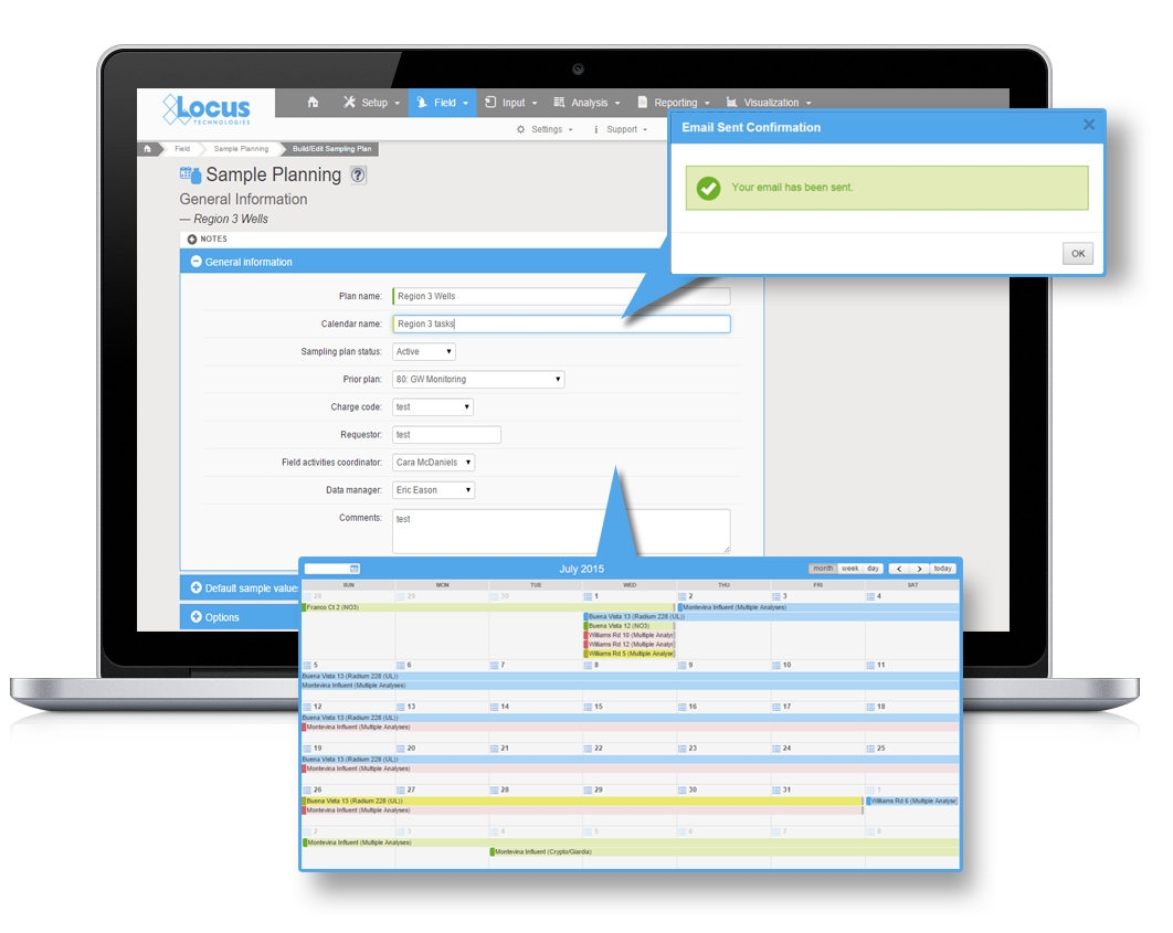
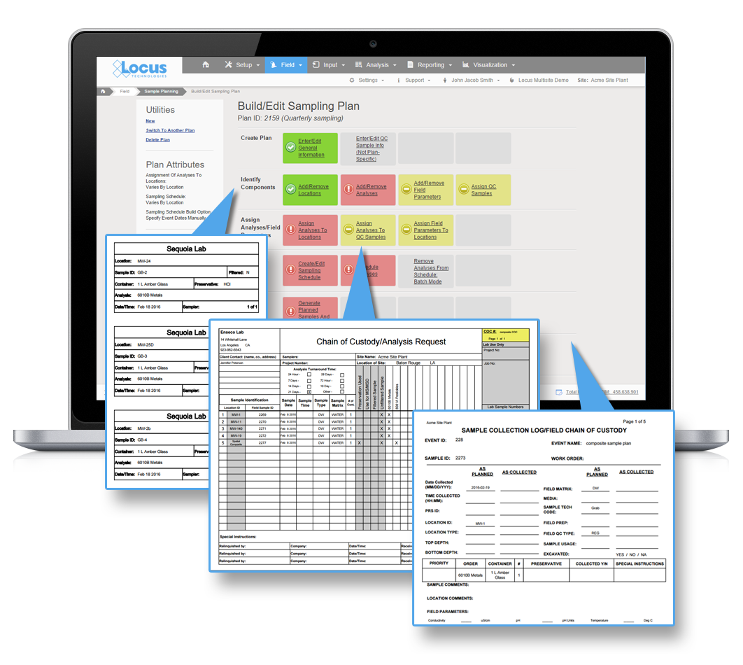
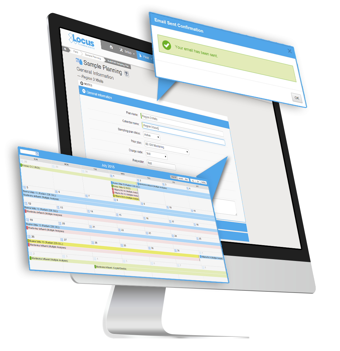
Sample planning can be a valuable and necessary tool for many in highly regulated fields, including water utilities, where adherence to regulatory defined sampling schedules is essential. Moreover, if you have reviewed the drinking water requirements, you know the regulations require complex and variable schedules ranging from monthly samples at routine locations for a set list of parameters to once every five, seven, or nine years at other locations for a completely different list of parameters. Missing a required sampling event can mean fines and public notice to customers.
Other industries face similar complex sampling needs and the financial and reputational impacts can be hefty for missing required samples. So if you are currently an EIM user, or considering an environmental information management system, don’t forget about sample planning components that will save you time and money.
Here are some benefits of Sample Planning that may make you a believer.
Sample Planning in EIM excels in streamlining repetitive sampling, such as required drinking water samples, or quarterly monitoring well samples. Any sampling events with a schedule from daily to once every 10 years can be planned in EIM’s module and reused again and again, even with tweaks to the schedule for the samples to be collected. Imagine the time savings and the simplicity of having your regulatory requirements all lined out for the year and not have to worry about missing required samples. For water utilities, this is especially valuable given the very strict schedules and the public health implications of missing sampling events.
When samples are planned in EIM, it is a few simple clicks of the mouse to generate COCs, work lists, and bottle labels for the field crew. This saves time for the field and office staff, and helps ensure they collect the needed samples and not miss a collection or a field or laboratory parameter. Moreover, higher levels of accuracy and fewer transcription errors are ensured as sample IDs and requested analyses are printed electronically rather than entered by hand.
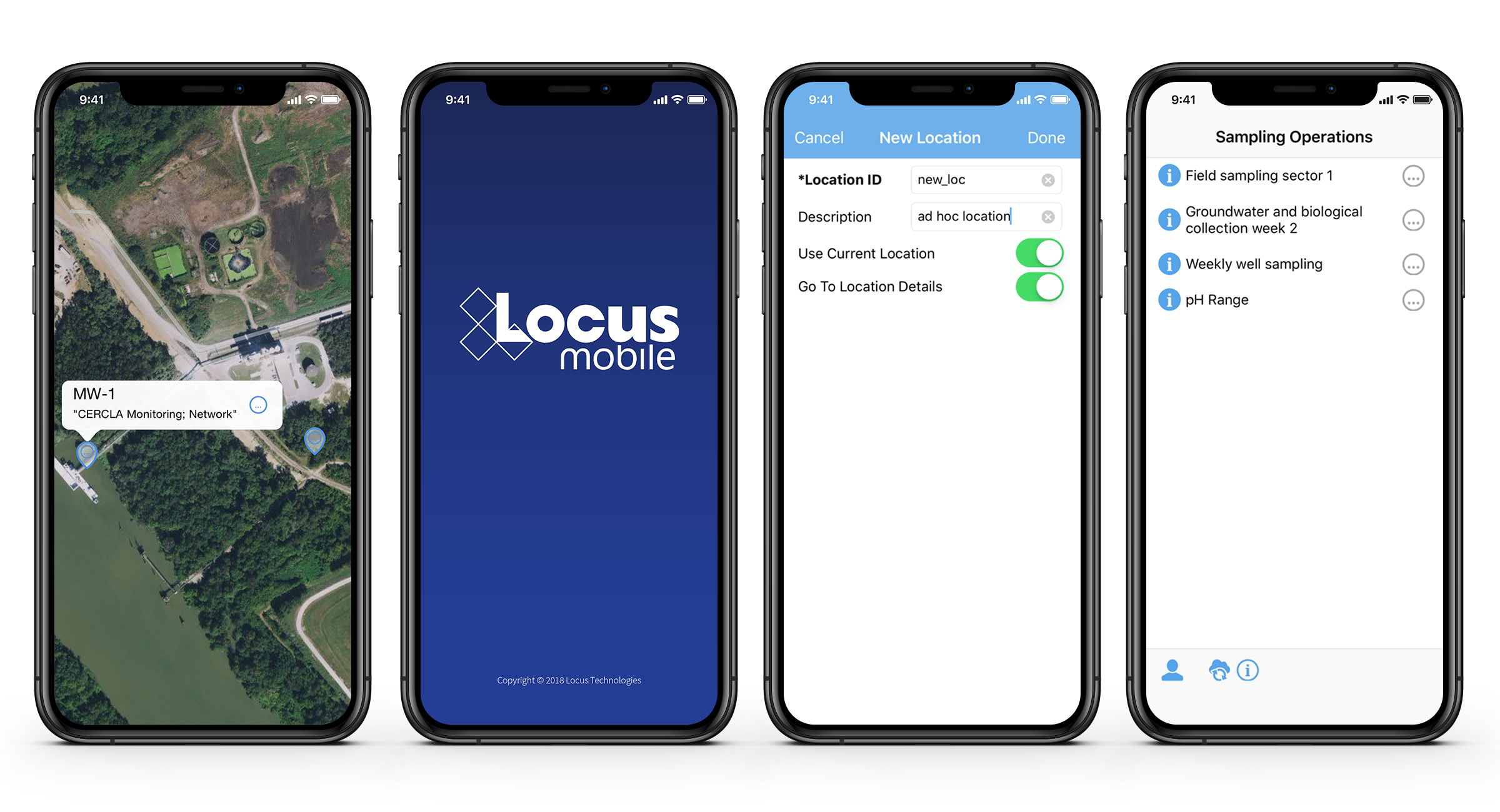
For customer’s considering using Locus Mobile to streamline their field data collection, Sample Planning is a natural fit. All the samples planned in the Sample Planning module can be delivered directly to Locus Mobile for one or more field staff. You can even have multiple different events sent to the field crew so they can plan ahead in the field. All the collected data is uploaded to EIM in real-time (if service is available) or later (if not) for review and final checks after the field event is concluded. Imagine giving your sampling teams the weekly plan and tracking the progress each day as they sync their data. A handy feature of Locus Mobile, it can remove all the previously collected samples from the plan each day to make your field sampler’s life much simpler.
Larger drinking water utilities will find the integration of Sample Planning and mobile quite appealing, especially with daily sampling by multiple sampling teams and a large number of required routine samples.
 All your required field sample information is already in EIM for your sampling event.
When lab data comes back from the lab, you no longer need to enter in the field sample information, it will already be in EIM.
For drinking water utilities, where you may be sampling daily for chlorine at your sample locations, imagine seeing the results across your distribution system instantly, and ability to see it on a map in near real time. Even better, you can share the results with your operations team with a simple dashboard link.
By using Sample Planning, you will know exactly what samples have and have not been collected. You will also know which ones were collected late, and which ones are yet to be collected. This type of information can help ensure you don’t’ miss required samples, and identify schedule impacts when collection is not going according to plan.
When missed samples are identified, its easy to add to the next day’s sampling and send that information to field teams using the integrated mobile app.
 Gain ability to track receipt of laboratory results with fine precision
For customers that need to track laboratory results down to the method and analyte level, Sample Planning will make that tedious task easy. Therefore, if you ordered an EPA Method 6010C analysis and no result for lead is reported, you will know immediately when the results arrive back from the lab that the deliverable is incomplete. EIM will also tell you when the lab substituted one method for another. You can then decide whether this change is acceptable or not. Because most regulations include a long list of required analytes and acceptable methods, this type of detail is invaluable to help ensure that you remain in compliance.
Trying to review laboratory invoices, especially for large sampling events or complex sampling programs, can be a chore. With EIM’s Sample Planning module, most of the hard work is already done for you. Once you have all your data back, EIM will tell you:
Sorry, no posts matched your criteria