Environmental Technology Blog
 https://www.locustec.com/wp-content/uploads/2022/02/25Anniversary.jpg
419
390
Locus Product Team
https://www.locustec.com/wp-content/uploads/2023/12/locus_logo_2x.png
Locus Product Team2022-07-13 10:39:112025-03-17 12:37:52Locus at 25 Years: A Unified Approach to EHS and ESG
https://www.locustec.com/wp-content/uploads/2022/02/25Anniversary.jpg
419
390
Locus Product Team
https://www.locustec.com/wp-content/uploads/2023/12/locus_logo_2x.png
Locus Product Team2022-06-17 09:02:422025-03-17 12:37:52Locus at 25 Years: Blockchain for Emissions Management
https://www.locustec.com/wp-content/uploads/2022/02/25Anniversary.jpg
419
390
Locus Product Team
https://www.locustec.com/wp-content/uploads/2023/12/locus_logo_2x.png
Locus Product Team2022-05-20 06:36:392025-03-17 12:37:52Locus at 25 Years: How Did We Fund Locus?
https://www.locustec.com/wp-content/uploads/2022/02/25Anniversary.jpg
419
390
Locus Product Team
https://www.locustec.com/wp-content/uploads/2023/12/locus_logo_2x.png
Locus Product Team2022-05-16 09:48:452025-03-17 12:37:52Locus at 25 Years: Locus Platform, Multitenant Architecture, the Secret of our Success
https://www.locustec.com/wp-content/uploads/2022/02/25Anniversary.jpg
419
390
Locus Product Team
https://www.locustec.com/wp-content/uploads/2023/12/locus_logo_2x.png
Locus Product Team2022-05-06 05:41:422025-03-17 12:37:53Locus at 25 Years: Locus EIM and the Triumph of the SaaS Model
https://www.locustec.com/wp-content/uploads/2022/02/25Anniversary.jpg
419
390
Locus Product Team
https://www.locustec.com/wp-content/uploads/2023/12/locus_logo_2x.png
Locus Product Team2022-04-29 05:56:162025-03-17 12:37:53Locus at 25 Years: Who is Locus Technologies?
https://www.locustec.com/wp-content/uploads/2022/02/25Anniversary.jpg
419
390
Locus Product Team
https://www.locustec.com/wp-content/uploads/2023/12/locus_logo_2x.png
Locus Product Team2022-04-26 10:15:162025-03-17 12:37:53The Past, Present, and Future of EHS & ESG
https://www.locustec.com/wp-content/uploads/2022/02/25Anniversary.jpg
419
390
Locus Product Team
https://www.locustec.com/wp-content/uploads/2023/12/locus_logo_2x.png
Locus Product Team2022-07-13 10:39:112025-03-17 12:37:52Locus at 25 Years: A Unified Approach to EHS and ESG
https://www.locustec.com/wp-content/uploads/2022/02/25Anniversary.jpg
419
390
Locus Product Team
https://www.locustec.com/wp-content/uploads/2023/12/locus_logo_2x.png
Locus Product Team2022-06-17 09:02:422025-03-17 12:37:52Locus at 25 Years: Blockchain for Emissions Management
https://www.locustec.com/wp-content/uploads/2022/02/25Anniversary.jpg
419
390
Locus Product Team
https://www.locustec.com/wp-content/uploads/2023/12/locus_logo_2x.png
Locus Product Team2022-05-20 06:36:392025-03-17 12:37:52Locus at 25 Years: How Did We Fund Locus?
https://www.locustec.com/wp-content/uploads/2022/02/25Anniversary.jpg
419
390
Locus Product Team
https://www.locustec.com/wp-content/uploads/2023/12/locus_logo_2x.png
Locus Product Team2022-05-16 09:48:452025-03-17 12:37:52Locus at 25 Years: Locus Platform, Multitenant Architecture, the Secret of our Success
https://www.locustec.com/wp-content/uploads/2022/02/25Anniversary.jpg
419
390
Locus Product Team
https://www.locustec.com/wp-content/uploads/2023/12/locus_logo_2x.png
Locus Product Team2022-05-06 05:41:422025-03-17 12:37:53Locus at 25 Years: Locus EIM and the Triumph of the SaaS Model
https://www.locustec.com/wp-content/uploads/2022/02/25Anniversary.jpg
419
390
Locus Product Team
https://www.locustec.com/wp-content/uploads/2023/12/locus_logo_2x.png
Locus Product Team2022-04-29 05:56:162025-03-17 12:37:53Locus at 25 Years: Who is Locus Technologies?
https://www.locustec.com/wp-content/uploads/2022/02/25Anniversary.jpg
419
390
Locus Product Team
https://www.locustec.com/wp-content/uploads/2023/12/locus_logo_2x.png
Locus Product Team2022-04-26 10:15:162025-03-17 12:37:53The Past, Present, and Future of EHS & ESG https://www.locustec.com/wp-content/uploads/2020/05/locus_graphic_ai_cover.jpg
500
950
Neno Duplan
https://www.locustec.com/wp-content/uploads/2023/12/locus_logo_2x.png
Neno Duplan2022-04-13 10:02:062025-08-26 13:59:04Artificial Intelligence & Blockchain Applied to Water & Energy
https://www.locustec.com/wp-content/uploads/2020/05/locus_graphic_ai_cover.jpg
500
950
Neno Duplan
https://www.locustec.com/wp-content/uploads/2023/12/locus_logo_2x.png
Neno Duplan2022-04-13 10:02:062025-08-26 13:59:04Artificial Intelligence & Blockchain Applied to Water & Energy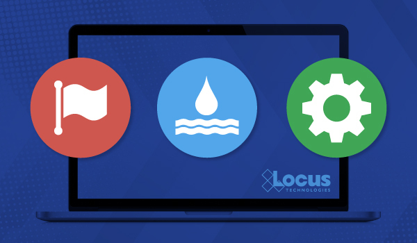 https://www.locustec.com/wp-content/uploads/2022/02/update_water_management_software-cover.jpg
350
600
Locus Product Team
https://www.locustec.com/wp-content/uploads/2023/12/locus_logo_2x.png
Locus Product Team2022-02-23 06:40:502025-07-28 14:14:455 Major Signs That You Need to Replace Your Water Data Management Solution
https://www.locustec.com/wp-content/uploads/2022/02/update_water_management_software-cover.jpg
350
600
Locus Product Team
https://www.locustec.com/wp-content/uploads/2023/12/locus_logo_2x.png
Locus Product Team2022-02-23 06:40:502025-07-28 14:14:455 Major Signs That You Need to Replace Your Water Data Management Solution