
01 // ANALYTICAL AND LABORATORY DATA (EIM)

The Science-Based Engine Backing Your Environmental Program

Environmental Information Management

02 // Purpose-built Software

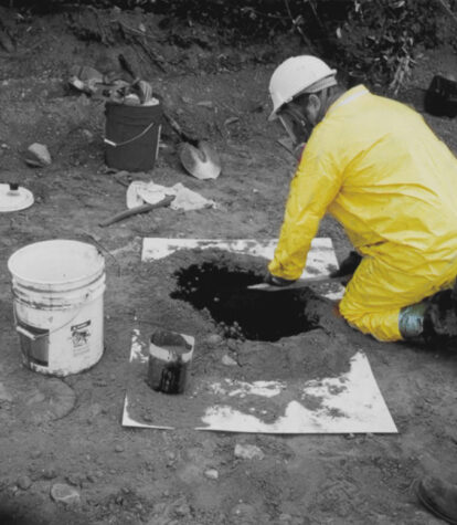
environmental sampling data in the field

Protecting Field Sample and Analytical Data

Questions like where contamination stands, whether cleanup is working, and what’s in a community's water supply leave no room for doubt. The most consequential environmental decisions depend entirely on the quality of the data behind them.

Locus EIM has been the system of record for that data since 1999 – meticulously managing complex water, air, soil, biological, geological, radionuclide, and field data from sample planning through regulatory reporting. Today it secures 535,302,146 analytical records from 1,664,220 locations worldwide, supporting DoE national laboratories, Fortune 500 energy and chemical companies, and water utilities serving millions of people.


Locus EIM

Locus EIM is a purpose-built SaaS for environmental data management — designed from the ground up to handle every data source, every analytical media type, and every regulatory reporting requirement that environmental science programs encounter.

It runs on a secure, multitenant, mobile-enabled AWS cloud with 99.99%+ uptime third-party verified since 2014, backed by SOC 1 Type 2 and SOC 2 Type 2 audits. Predictable subscription pricing. No hardware. No IT burden. Scales from a single-site water utility to a global energy company operating across dozens of countries without changing a single line of code.

Sample Planning →
Locus Mobile →
Locus GIS →

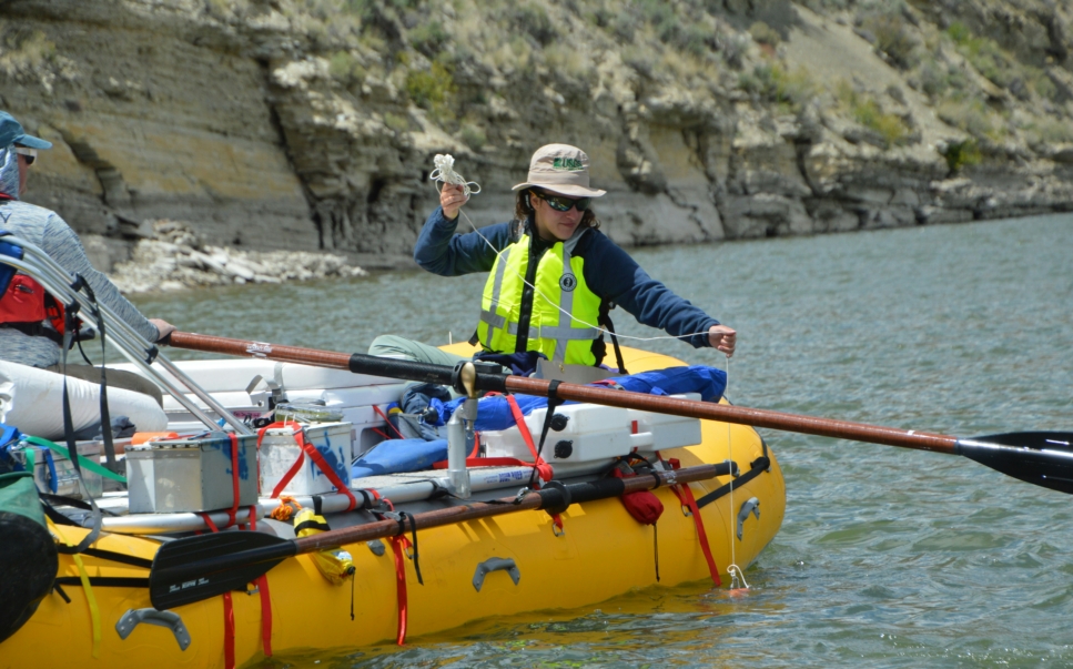
Field work

Why Locus EIM is trusted by environmental professionals

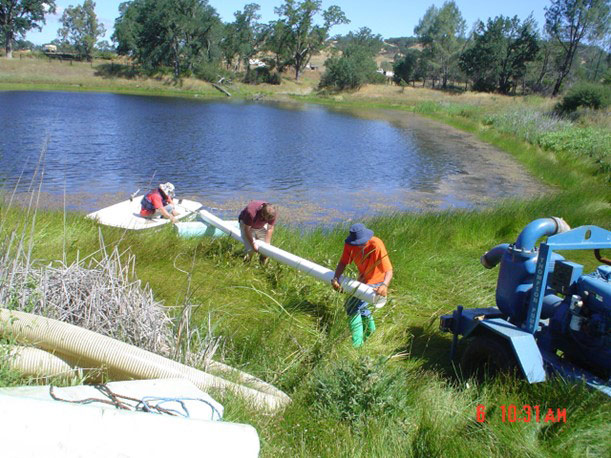
Thomas Ranch Testing

Make decisions with confidence because the data is defensible.

When a regulator asks how a result was derived, or a lawyer asks what the data shows, EIM gives environmental professionals an answer that is traceable, timestamped, and audit-ready.

Spend less time managing data and more time interpreting it.

A system that handles EDDs, validates automatically, generates regulatory reports, and connects to the visualization tools professionals already use means environmental scientists recoup the hours that manual data management consumes.

Never risk a sampling program to a data gap or a chain of custody error.

From the moment a sample is planned through the moment the laboratory result enters the record, every step is tracked, validated, and linked — with no paper forms, no re-entry, and no version discrepancy.

Locus Oul

Manage programs of any size and complexity in one place.

Whether the program covers three monitoring wells at a single site or 6,000 locations across a worldwide enterprise, EIM handles the analytical data with the same validated architecture and the same reporting toolkit.

Give regulators, management, and the public exactly the data they need.

EIM produces Discharge Monitoring Reports, Consumer Confidence Reports, boring logs, crosstab reports, and export files in required regulatory formats — plus interactive GIS maps, dashboards, and visualizations for every other audience.

Adopt new regulatory requirements without rebuilding your data program.

New PFAS parameters, new MCLs, new sampling requirements, no problem. EIM accommodates them as they arrive, without recoding, without consultant engagement, and without disrupting existing programs.

04 // Jim Higinbotham, Area Manager, Technical Services, ExxonMobil Environmental Services

"Locus EIM allowed us to centralize all our sites in a single system of record.

We used EIM to mine data for opportunities for cost savings arising from targeted reductions in sampling frequencies and analyses. Most software implementations at ExxonMobil fail not because the software cannot do what it's supposed to do, but because the software cannot scale to the size of ExxonMobil's needs. Locus scaled without problems."

Managed end-to-end

05 // Environmental Data Lifecycle

  • Plan

    Build intricate sampling workflows specifying required samples, parameters, and schedules across multiple sites and intervals. Generate mobile-enabled chains of custody, work lists, and bottle labels directly from the sample plan.

  • Collect

    Field crews use Locus Mobile (offline or online) to capture measurements, photos, and field observations. Data syncs to EIM the moment connectivity is available, without manual re-entry.

  • Load

    Single-file and multi-file EDD upload from LIMS. Map fields and flag errors during upload for quality control. SCADA, sensors, instruments, and manual entry forms bring in every other data type.

  • Validate

    Every incoming data point is checked against configured thresholds and scientific rules. Outliers and exceedances are flagged automatically. Provenance of every data point and every calculation is tracked before anything enters the permanent record.

  • Analyze

    Navigate results, groundwater levels, field measurements, and subsurface data using the Project Manager Console, GIS maps, contour plots, hydrographs, regression charts, time series visualizations, and advanced SQL query tools.

  • Report

    Generate DMRs, Consumer Confidence Reports, crosstab reports, boring logs, and regulatory export files. Export in XML, delimited text, Excel, JSON, and OData. Connect to Power BI, Tableau, and any API-compatible analytics environment.

Locus EIM software is built for the toughest environmental data

06 // Feature Highlights

Sample Planning and Field Data Collection

Locus EIM's Sample Planning Module builds, executes, and tracks a complete sampling program from cradle to submitted result. Sampling workflows specify required samples, parameters, and schedules across multiple sites — whether daily routine measurements, quarterly monitoring events, or once-every-nine-years regulatory requirements. Chains of custody, work lists, and bottle labels generate directly from the plan. Automated notifications alert users to upcoming events. Field crews capture measurements, photos, and field observations on Locus Mobile (online or offline) and data syncs to EIM automatically. Every sample is traceable from the moment it is planned through the moment the laboratory result enters the permanent record.

Locus Mobile →
Sample Planning →

Laboratory EDD Management

Locus EIM resolves data quality problems at the source, where they originate. Upload individual or multiple EDD files. Map fields and flag errors during upload to handle format variations, runs validation checks on every incoming deliverable, and ensure quality control. A broad library of preloaded EDD formats covers the most common LIMS outputs. End users can create additional EDD formats without vendor involvement, without additional fees, and without a development request. A dedicated laboratory interface lets labs submit data directly into EIM on behalf of their clients, separating the laboratory's submission workflow from the client's data management environment. Laboratory invoices are tracked alongside deliverables in the same system. Supporting documents can be stored in EIM or the customer's SharePoint library. The result: a complete, auditable chain of custody from laboratory bench to environmental database.

Data Validation →
Bench Sheets →

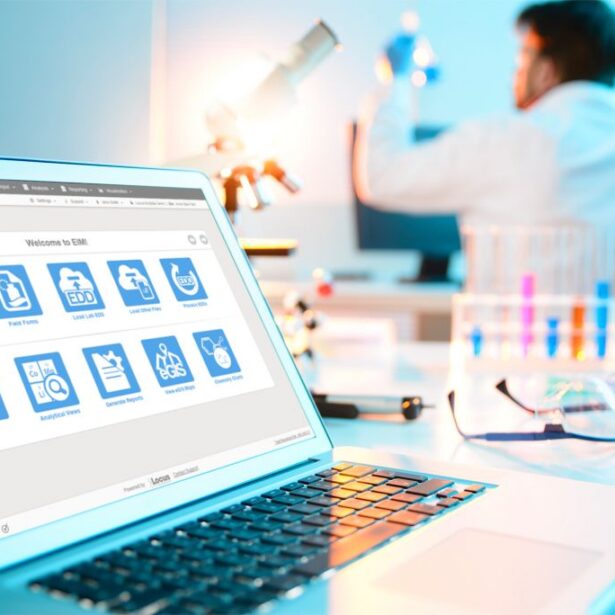
Man working on laptop as demonstration of AI for EHS and ESG

Data Validation and Scientific Calculation Engine

Environmental data is among the most complex datasets that exist. It is gathered through multiple methods from multiple sources, subject to differing regulatory requirements at the federal, state, and local level, and it carries real consequences when it is wrong. Locus EIM's validation engine addresses that complexity from the moment data arrives. Every incoming data point is checked against configured acceptance thresholds. Outliers and exceedances are flagged automatically and routed to the appropriate users before they enter the permanent record. Every data point and every calculation is tracked with its full provenance: who entered it, when, what it was derived from, and what formula or rule was applied. The software supports hundreds of universal scientific formulas for automated complex calculations across data fields. Power users define and execute one-off calculations, including complex formulas for chemical analyses, decay corrections, or unit conversions, without involving Locus development staff. Every step is timestamped and user-attributed, creating an audit trail that supports regulatory scrutiny at any level.

Data Validation →

GIS Mapping and Scientific Visualization

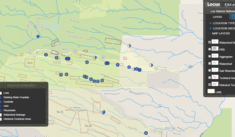
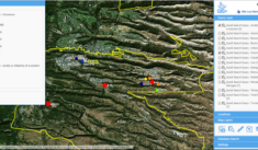
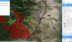
Environmental data becomes even more impactful when it can be seen spatially, temporally, and in relation to the regulatory thresholds that matter. Locus EIM integrates with Esri ArcGIS Online to generate interactive maps overlaying EIM data against plant boundaries, watersheds, and areas of concern. Locus GIS+ extends the spatial toolkit with buffering, spatial queries, and contouring — producing the groundwater contour maps, plume delineations, and exceedance zone visualizations that remediation and compliance decisions require. Beyond GIS, EIM generates configurable visualizations, such as bar graphs, time series charts, scatter plots, tree maps, regression charts, and hydrographs. Dynamic forecasting charts and augmented reality tools extend the analytical visualization toolkit further. All maps and visualizations export in standard formats for use in regulatory submissions, management reporting, and public access applications.

Locus GIS+ →
Data Visualization →

Radionuclide compliance hero

Comprehensive Environmental Data Domains

Environmental programs rarely operate in a single matrix, and EIM was built to reflect that reality. Groundwater measurements, well and borehole data, and boring log generation sit alongside surface water reports, drinking water quality data, Consumer Confidence Reports, and Lead and Copper rule compliance. Ecological and biological sampling programs are supported with full taxonomic data management. Radionuclide data for ambient air monitoring via AirNet serves nuclear power plants and DoE facilities managing RETS/REMP compliance. For oil and gas operators, produced water management is now enriched by a connection to the latest USGS National Produced Waters Geochemical Database — more than a century of aggregated government geochemical records available alongside operational data. Stormwater, waste, precipitation, vapor intrusion, and indoor air quality programs round out the picture. Whatever the media type, it belongs in EIM.

Water and Wastewater →
Radionuclide Compliance →

PFAS and Emerging Contaminant Management

PFAS represent the most dynamic and analytically complex regulatory challenges in environmental data management today. Locus EIM holds 4,675,831 validated PFAS records collected from 38,553 global sites, covering all 430 chemicals identified in the EPA PFAS inventory and tracked across water, soil, and biota. That scale is a direct product of EIM's multitenant architecture: consistently validated, consistently structured data across every customer. This enables cross-portfolio trend identification and contamination pattern analysis that isolated per-customer databases cannot replicate. New analytical parameters enter the EIM database automatically when laboratory results arrive. And as PFAS regulations evolve (i.e., new MCLs, new TRI reporting requirements, new UCMR cycles), EIM accommodates them without manual reconfiguration and without disrupting existing sampling programs.

PFAS Tracking →
Managing Benzene →

Reporting, Export, and API Connectivity

Environmental programs are measured by their outputs: the reports that regulators accept, the data that legal teams defend, the exports that feed analytics platforms. Locus EIM produces all of them from the same validated source. Formatted Discharge Monitoring Reports, Consumer Confidence Reports, crosstab reports, boring logs, and state and federal regulatory export files are generated from EIM data directly. Results are exported as XML, delimited text, Excel, JSON, OData, and other formats. Locus APIs connect EIM to Salesforce Tableau, Microsoft Power BI, GIS software, ERP systems, and HR platforms. The Expert Query tool constructs custom SQL that is immediately API-compatible, making any EIM dataset available to any analytics environment. Supporting documents, project costs, invoices, and well pump data are all tracked within the same system.

API Integrations →
Locus GIS+ →
Water and Wastewater →

07 // Neno Duplan, Founder and CEO, Locus Technologies

"Our multitenant SaaS infrastructure uniquely positions Locus as the only platform capable

... of aggregating, analyzing, and reporting critical environmental data in real-time. Every day, Locus EIM helps thousands of professionals make informed decisions based on comprehensive and validated data."

08 // THE STAKES OF ENVIRONMENTAL DATA

This is the data that changes lives. It deserves a system built for those stakes.

Some environmental data is routine. Much of it is not. The groundwater contamination at a community's doorstep, the industrial compounds in a watershed, the nuclear legacy buried beneath a national laboratory — this is the kind of data that shapes health outcomes, informs legal proceedings, and determines what communities know about where they live. Four films have made that reality recognizable to everyone.

The data behind each of those stories is exactly the kind Locus EIM was built to manage. It’s vast, complex, analytically demanding, and consequential. If EIM can be trusted with data of this weight and complexity, it can be trusted with any environmental data program.

Movie Summary: Hexavalent chromium in drinking water. A community's health, a landmark case, and the data that proved it.

Locus founder, Neno Duplan, served PG&E as an environmental consultant from 1998 to 2000, gaining first-hand experience with the environmental and regulatory demands.

Movie Summary: Industrial solvent contamination in a Massachusetts town and years of complex analytical data at the center of the litigation.

While at Canonie Environmental, Duplan worked in the world of groundwater contamination, analytical science, remediation, and environmental evidence.

Today, Locus software manages consequential data connected to organizations and places represented in these films.

Movie Summary: PFAS compounds in rivers, animals, and people. The science that took decades to assemble — and the data management that finally made sense of it.

Locus began managing PFAS data for DuPont and related successor businesses in 2011, years before the film brought the issue to movie audiences.

Movie Summary: The Manhattan Project in Los Alamos, NM, and the environmental legacy of the most consequential science program in history.

Locus software supports the management, validations, and public accessibility of environmental monitoring and legacy cleanup data associated with Los Alamos National Laboratory.

09 // The Story Continues

Oppenheimer's story didn't end with The Manhattan Project.

Los Alamos National Laboratory's environmental data is now public.

Los Alamos National Laboratory (LANL), the research site at the center of Oppenheimer's story, carried an environmental legacy long after the film's era ended. Decades of monitoring data from the cleanup of that legacy were scattered across a dozen independent databases that no one could easily combine, query, or share with the surrounding community.

Locus EIM changed that. LANL consolidated more than 14 million environmental monitoring records into a single EIM system. Then Locus built Intellus, a public-facing deployment of EIM available at intellusnm.com, so that any community member can query that data in real time. The same records that scientists use to guide cleanup decisions are accessible to the public, continuously updated, without delay.

Intellus New Mexico

10 // Chris Echohawk, Office of Operations Improvement, Los Alamos National Laboratory

"High-quality data is a crucial component in environmental stewardship and our commitment to transparency with the public."

11 // Software Demonstration

See Locus EIM in action

The best way to evaluate EIM is to see it working with your media types, your laboratory relationships, your regulatory programs, your visualization requirements. Talk to a Locus specialist who has worked with programs as complex as yours.
Request a Personalized Demo

Frequently Asked Questions

12 // FAQ

EIM manages water, air, soil, biological, geological, radionuclide, and field data — from laboratory results, field measurements, SCADA systems, sensors, and instruments. Specialized modules handle groundwater and borehole data, surface water, drinking water quality, biological and ecological sampling, radionuclide monitoring, produced water, vapor intrusion, and precipitation. The platform secures 535,302,146 analytical records from 535,302,146 worldwide locations.

Map fields and flag errors during EDD upload to handle format variations, run validation checks on every incoming deliverable, and ensure quality control. A broad library of preloaded EDD formats covers common LIMS outputs. End users can create additional custom EDD formats without vendor assistance or additional fees. A dedicated laboratory interface lets labs submit data directly. Laboratory invoices track alongside deliverables in the same system.

Every incoming data point is checked against configured acceptance thresholds and scientific rules. Outliers and exceedances are flagged automatically and routed to appropriate users before they enter the permanent record. The provenance of every data point and every calculation is tracked with timestamps and user attribution at every step. The software supports hundreds of universal scientific formulas, and power users can define one-off calculations including complex formulas for chemical analyses.

EIM integrates with Esri ArcGIS Online for interactive maps with plant boundaries, watersheds, and exceedance zones. Locus GIS+ supports users with or without ArcGIS licensing, and offers buffering, spatial queries, and contouring. Configurable visualizations include bar graphs, time series charts, scatter plots, tree maps, regression charts, and hydrographs. Dynamic forecasting charts and augmented reality extend the toolkit. All maps and visualizations export in standard formats.

EIM manages all 430 chemicals identified in the EPA PFAS inventory, tracked across water, soil, and biota samples from sites worldwide. As of X, Locus clients had collectively contributed 4,675,831 validated PFAS records from 38,553 global sites, making EIM the most extensive real-time, aggregated global PFAS analytical dataset available. EIM is designed to accommodate new PFAS parameters and analytical methods as regulations evolve, without disrupting existing programs. Both the standard EIM configuration and the EIM Water configuration for utilities are built with ever-changing regulatory requirements in mind.

Locus APIs connect EIM to Salesforce Tableau, Microsoft Power BI, GIS software, ERP systems, and HR platforms. The Expert Query tool builds custom SQL that is immediately API-compatible. Results export in XML, delimited text, Excel, JSON, OData, and other formats.

EIM is a true multitenant cloud SaaS that scales across users, sites, and data volumes without per-instance management. Every customer receives continuous updates simultaneously. Petroleum companies manage 6,000-plus sites. Municipal utilities use it daily. All run on the same platform with predictable subscription pricing, no hardware, and no IT burden.